Latitude: 51.8938 / 51°53'37"N
Longitude: -1.1481 / 1°8'52"W
OS Eastings: 458722
OS Northings: 222042
OS Grid: SP587220
Mapcode National: GBR 8XJ.BJM
Mapcode Global: VHCX4.1NXJ
Plus Code: 9C3WVVV2+GQ
Entry Name: Station House Approximately 15 Metres North West of Level Crossing
Listing Date: 20 January 1988
Grade: II
Source: Historic England
Source ID: 1046495
English Heritage Legacy ID: 243536
ID on this website: 101046495
Location: Bicester, Cherwell, Oxfordshire, OX26
County: Oxfordshire
District: Cherwell
Civil Parish: Bicester
Built-Up Area: Bicester
Traditional County: Oxfordshire
Lieutenancy Area (Ceremonial County): Oxfordshire
Church of England Parish: Bicester with Caversfield
Church of England Diocese: Oxford
Tagged with: Building
BICESTER LONDON ROAD SP5822S (West side) 3/61 Station House approx. 15m. NW of level crossing II
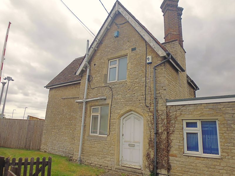
Former station-master's house. c.1850. Coursed squared limestone with ashlar dressings; plain-tile roofs with rubble and brick stacks. Z-shaped plan. One storey plus attics. Tudor style. Front breaks forward to right in a gabled cross wing, which contains a Tudor-arched doorway with a 4-panel door plus, at each floor, a 2-light small-pane casement with chamfered stone surround, wood mullion and 4-centred relieving arch. Lateral stack, rising from right return wall, has a rubble base and 2 tall brick diagonal shafts. Gabled return wall of blind section to left has aligned windows of 3 and 2 lights, and a further double-shafted lateral stack rises to rear. Central rear wing is in similar style. Gables have plain bargeboards with moulded apex pendants. Interior not inspected. Part of the London and North Western Railway which opened 1850.
Listing NGR: SP5872222042
External links are from the relevant listing authority and, where applicable, Wikidata. Wikidata IDs may be related buildings as well as this specific building. If you want to add or update a link, you will need to do so by editing the Wikidata entry.


Other nearby listed buildings