Latitude: 51.538 / 51°32'16"N
Longitude: -0.9014 / 0°54'4"W
OS Eastings: 476293
OS Northings: 182694
OS Grid: SU762826
Mapcode National: GBR C4S.DY8
Mapcode Global: VHDWG.BLBT
Plus Code: 9C3XG3QX+6F
Entry Name: Chantry House
Listing Date: 25 January 1951
Grade: I
Source: Historic England
Source ID: 1047033
English Heritage Legacy ID: 246067
ID on this website: 101047033
Location: Henley-on-Thames, South Oxfordshire, RG9
County: Oxfordshire
District: South Oxfordshire
Civil Parish: Henley-on-Thames
Built-Up Area: Henley-on-Thames
Traditional County: Oxfordshire
Lieutenancy Area (Ceremonial County): Oxfordshire
Church of England Parish: Henley-on-Thames
Church of England Diocese: Oxford
Tagged with: Building
1. CHURCH AVENUE 5355 (East Side) Chantry House
SU 7582 1/55 25.1.51.
I GV
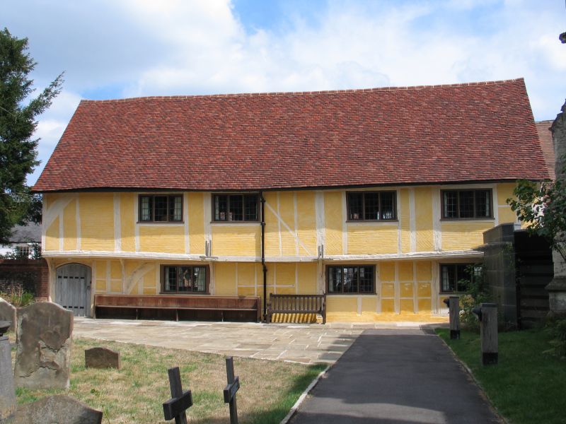
2. Circa 1400. Chantry Cottage (No 20, Thameside) forms the lower storey of Chantry House but the whole is one timber framed building. Rectangular shape. East side, 3 storeys, west, 2 storeys. Plaster infilling to substantial wall framing. Western ground floor with brick infilling and moulded bressumer above. 4 windows, casements with modern leaded glazing. Reproduction door to original Tudor doorway with spandrels. Eastern side has similar fenestration but 3 early small 4 light windows with early leaded glazing on top floor. Projecting 2 storey gabled wing. Later ground floor, gabled porch. Interior has exposed timbering with roof structure exposed on upper floor.
The surface of the lane forms part of a group with Nos 1 to 7 (consec) Chantry House and Chantry Cottage, No 20 Thameside, Nos 8 to 20 (consec), the Brewery Buildings No 86A New Street and St Mary's Parish Church, Hart Street.
Listing NGR: SU7629082689
External links are from the relevant listing authority and, where applicable, Wikidata. Wikidata IDs may be related buildings as well as this specific building. If you want to add or update a link, you will need to do so by editing the Wikidata entry.


Other nearby listed buildings