Latitude: 51.7607 / 51°45'38"N
Longitude: -1.2621 / 1°15'43"W
OS Eastings: 451027
OS Northings: 207153
OS Grid: SP510071
Mapcode National: GBR 7XL.KQY
Mapcode Global: VHCXV.20NJ
Plus Code: 9C3WQP6Q+75
Entry Name: Gateway Number 5 at Radcliffe Infirmary
Listing Date: 28 June 1972
Grade: II
Source: Historic England
Source ID: 1047069
English Heritage Legacy ID: 245946
ID on this website: 101047069
Location: Norham Manor, Oxford, Oxfordshire, OX2
County: Oxfordshire
District: Oxford
Electoral Ward/Division: North
Parish: Non Civil Parish
Built-Up Area: Oxford
Traditional County: Oxfordshire
Lieutenancy Area (Ceremonial County): Oxfordshire
Church of England Parish: Oxford St Giles
Church of England Diocese: Oxford
Tagged with: Gate
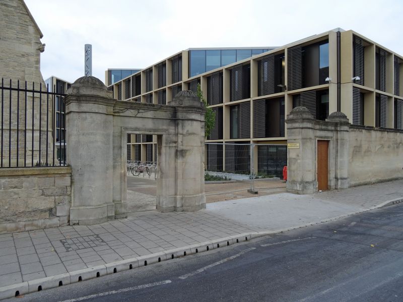
WOODSTOCK ROAD ROAD
1.
1485
(West Side)
Gateway No 5 at
Radcliffe Infirmary
SP 5107 SW 3/870B
II GV
2.
C19. 4 piers with moulded caps. Centre cast-iron gates, single gate on
either side.
The Radcliffe Infirmary Buildings form a group.
Listing NGR: SP5102707153
External links are from the relevant listing authority and, where applicable, Wikidata. Wikidata IDs may be related buildings as well as this specific building. If you want to add or update a link, you will need to do so by editing the Wikidata entry.


Other nearby listed buildings