Latitude: 51.764 / 51°45'50"N
Longitude: -1.2118 / 1°12'42"W
OS Eastings: 454488
OS Northings: 207551
OS Grid: SP544075
Mapcode National: GBR 8Z0.6G3
Mapcode Global: VHCXN.YX6L
Plus Code: 9C3WQQ7Q+J7
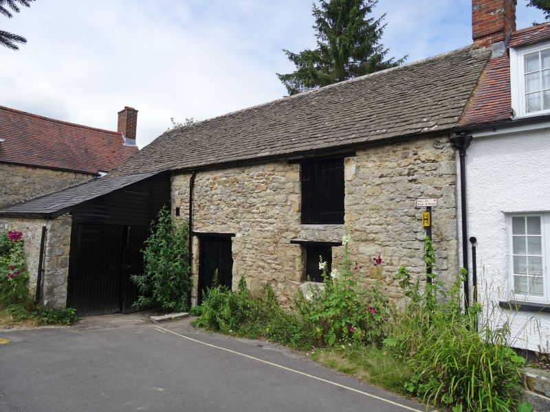
Entry Name: Building at rear of No 12 St Andrew's Road (fronting the Croft)
Listing Date: 28 June 1972
Grade: II
Source: Historic England
Source ID: 1047161
English Heritage Legacy ID: 245787
ID on this website: 101047161
Location: Headington, Oxford, Oxfordshire, OX3
County: Oxfordshire
District: Oxford
Electoral Ward/Division: Headington
Parish: Non Civil Parish
Built-Up Area: Oxford
Traditional County: Oxfordshire
Lieutenancy Area (Ceremonial County): Oxfordshire
Church of England Parish: Headington St Andrew
Church of England Diocese: Oxford
Tagged with: Building
This list entry was subject to a Minor Amendment on 7 August 2025 to reformat the text to current standards
SP 5407
18/52A
ST ANDREW'S ROAD (South Side)
Building at rear of No 12 (Fronting the Croft)
II
C18. Stone. Two storeys, various openings. Old stone tile roof.
Listing NGR: SP5448807551
External links are from the relevant listing authority and, where applicable, Wikidata. Wikidata IDs may be related buildings as well as this specific building. If you want to add or update a link, you will need to do so by editing the Wikidata entry.


Other nearby listed buildings