Latitude: 51.7563 / 51°45'22"N
Longitude: -1.2384 / 1°14'18"W
OS Eastings: 452664
OS Northings: 206674
OS Grid: SP526066
Mapcode National: GBR 8YY.ZP1
Mapcode Global: VHCXV.H35Y
Plus Code: 9C3WQQ46+GJ
Entry Name: Kings Mill
Listing Date: 12 January 1954
Grade: II
Source: Historic England
Source ID: 1047222
English Heritage Legacy ID: 245646
Also known as: King's Mill, Oxford
Kings Mill, Oxford
King's Mill
ID on this website: 101047222
Location: Headington Hill, Oxford, Oxfordshire, OX3
County: Oxfordshire
District: Oxford
Electoral Ward/Division: Marston
Parish: Non Civil Parish
Traditional County: Oxfordshire
Lieutenancy Area (Ceremonial County): Oxfordshire
Church of England Parish: New Marston
Church of England Diocese: Oxford
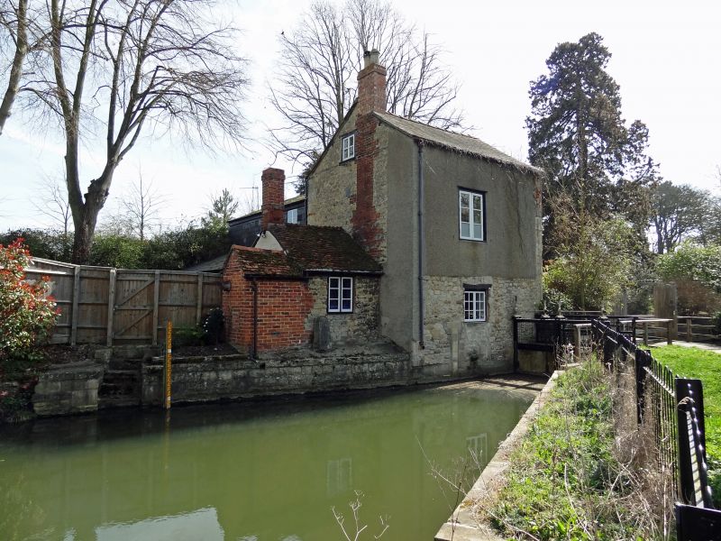
MARSTON ROAD 1. 1485 King's Mill SP 50 NW 24/766 II 2. Late C18. Rubble with dressed quoins. 2 storeys and attic. 3-light wooden mullioned casements. 2-light in the attic. Slate roof. Sluices in the old mill race.
Listing NGR: SP5266406674
External links are from the relevant listing authority and, where applicable, Wikidata. Wikidata IDs may be related buildings as well as this specific building. If you want to add or update a link, you will need to do so by editing the Wikidata entry.


Other nearby listed buildings