Latitude: 51.7272 / 51°43'37"N
Longitude: -1.2379 / 1°14'16"W
OS Eastings: 452733
OS Northings: 203440
OS Grid: SP527034
Mapcode National: GBR 8ZB.RTQ
Mapcode Global: VHCXV.HVF9
Plus Code: 9C3WPQG6+VR
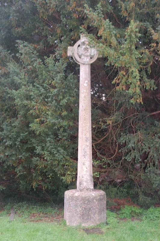
Entry Name: Cross in the Churchyard of the Church of St Mary
Listing Date: 28 June 1972
Grade: II
Source: Historic England
Source ID: 1047320
English Heritage Legacy ID: 245392
ID on this website: 101047320
Location: St Mary's Church, Iffley, Oxford, Oxfordshire, OX4
County: Oxfordshire
District: Oxford
Electoral Ward/Division: Rose Hill and Iffley
Parish: Non Civil Parish
Built-Up Area: Oxford
Traditional County: Oxfordshire
Lieutenancy Area (Ceremonial County): Oxfordshire
Church of England Parish: Iffley
Church of England Diocese: Oxford
Tagged with: Building
CHURCH WAY 1. 1485 (West Side) Cross in the Churchyard of the Church of St Mary SP 5203 SE 15/78A II 2. Ancient cross in churchyard to south of church, much restored. Tall medieval shaft with modern Celtic type cross.
Listing NGR: SP5273303440
External links are from the relevant listing authority and, where applicable, Wikidata. Wikidata IDs may be related buildings as well as this specific building. If you want to add or update a link, you will need to do so by editing the Wikidata entry.


Other nearby listed buildings