Latitude: 51.5456 / 51°32'44"N
Longitude: -0.9544 / 0°57'15"W
OS Eastings: 472605
OS Northings: 183487
OS Grid: SU726834
Mapcode National: GBR C4P.5HL
Mapcode Global: VHDWF.DDTZ
Plus Code: 9C3XG2WW+67
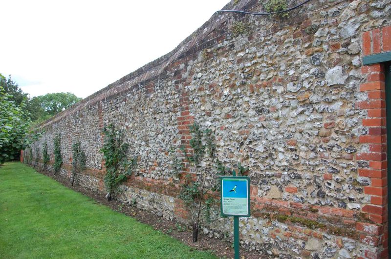
Entry Name: Greys Court, Outer Kitchen Garden Wall
Listing Date: 13 February 1985
Grade: II
Source: Historic England
Source ID: 1047392
English Heritage Legacy ID: 247150
ID on this website: 101047392
Location: Greys Green, South Oxfordshire, RG9
County: Oxfordshire
District: South Oxfordshire
Town: South Oxfordshire
Civil Parish: Rotherfield Greys
Traditional County: Oxfordshire
Lieutenancy Area (Ceremonial County): Oxfordshire
Church of England Parish: Rotherfield Greys
Church of England Diocese: Oxford
Tagged with: Building
ROTHERFIELD GREYS SU78SW 6/128 Greys Court, outer kitchen garden wall GV II Wall. C17. Flint with vertical brick bands; areas of mixed flint and brick; brick with flint facing. Encloses 3 sides of kitchen garden. Incorporates 2 sides of former tithe barn.
Listing NGR: SU7260383491
External links are from the relevant listing authority and, where applicable, Wikidata. Wikidata IDs may be related buildings as well as this specific building. If you want to add or update a link, you will need to do so by editing the Wikidata entry.


Other nearby listed buildings