Latitude: 51.7365 / 51°44'11"N
Longitude: -1.0597 / 1°3'34"W
OS Eastings: 465027
OS Northings: 204614
OS Grid: SP650046
Mapcode National: GBR B0X.2WX
Mapcode Global: VHCXY.LM45
Plus Code: 9C3WPWPR+H4
Entry Name: Tiddington House
Listing Date: 18 July 1963
Last Amended: 21 May 1985
Grade: II
Source: Historic England
Source ID: 1047476
English Heritage Legacy ID: 246950
ID on this website: 101047476
Location: Albury, South Oxfordshire, OX9
County: Oxfordshire
District: South Oxfordshire
Civil Parish: Tiddington-with-Albury
Built-Up Area: Tiddington
Traditional County: Oxfordshire
Lieutenancy Area (Ceremonial County): Oxfordshire
Church of England Parish: Albury
Church of England Diocese: Oxford
Tagged with: House
TIDDINGTON-WITH-ALBURY TIDDINGTON SP60SE 6/183 Tiddington House 18/07/63
GV II
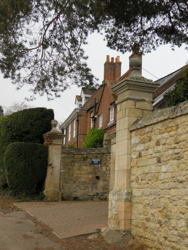
Substantial house. Early C18, extended C19. Flared brick with red brick dressings; plain-tile roof. Main range plus parallel rear wings. 2 storeys plus attics. Symmetrical 3-window front has storey band and moulded wooden cornice. Windows all have 16-pane sashes and rubbed-brick arches with cut decoration; those at ground floor also have stone and brick stepped keyblocks. C20 door. Roof is hipped to left and has 2 gabled roof dormers with moulded cornices and small-pane casements. Irregular C18 range to right with brick dentil eaves course, limestone gable wall and quoins, and similar roof dormer. Rear entirely C19. Interior: Stair hall at rear of main range has early C18 open-well stair, rising to attics, with turned balusters (of alternating pattern in lower flights). C18 fireplaces, doors, plaster coves and a shell alcove. Terrace in front has elaborate walls. (q.v.). (V.C.H.: Oxfordshire, Vol.I, p.8).
Listing NGR: SP6502704614
External links are from the relevant listing authority and, where applicable, Wikidata. Wikidata IDs may be related buildings as well as this specific building. If you want to add or update a link, you will need to do so by editing the Wikidata entry.


Other nearby listed buildings