Latitude: 51.5351 / 51°32'6"N
Longitude: -0.9034 / 0°54'12"W
OS Eastings: 476154
OS Northings: 182367
OS Grid: SU761823
Mapcode National: GBR C4S.LFV
Mapcode Global: VHDWG.9P72
Plus Code: 9C3XG3PW+2J
Entry Name: Congregational Church Manse
Listing Date: 28 October 1974
Grade: II
Source: Historic England
Source ID: 1047722
English Heritage Legacy ID: 246319
ID on this website: 101047722
Location: Henley-on-Thames, South Oxfordshire, RG9
County: Oxfordshire
District: South Oxfordshire
Civil Parish: Henley-on-Thames
Built-Up Area: Henley-on-Thames
Traditional County: Oxfordshire
Lieutenancy Area (Ceremonial County): Oxfordshire
Church of England Parish: Rotherfield Greys Holy Trinity
Church of England Diocese: Oxford
Tagged with: Building
1. READING ROAD 5355 (West Side)
Congregational Church Manse SU 7582 1/368
II GV
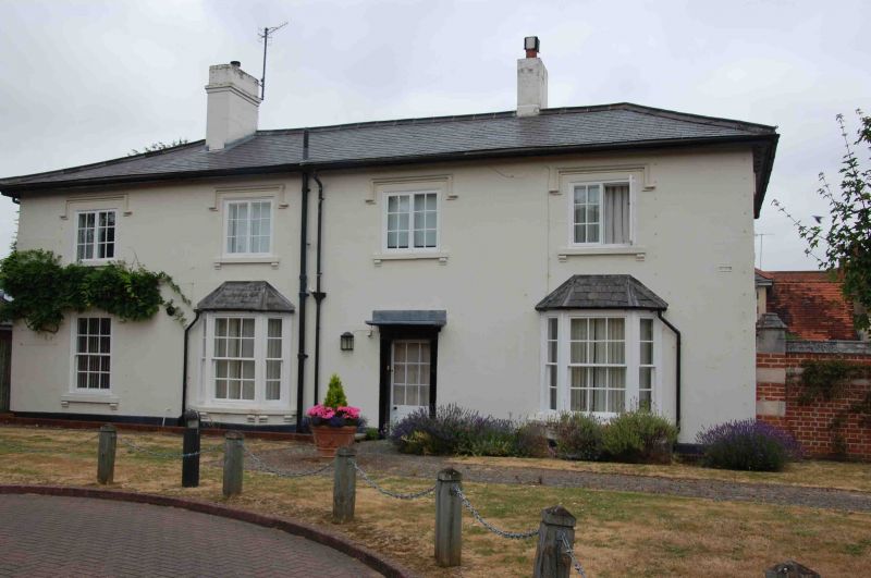
2. Early C19. On site of Manse which was home of Humphrey Gainsborough engineer and inventor 1748-1776, Stucco facade, hipped slate roof. 2 storeys. 3 windows, those of 1st floor 2 light casements with dripstone moulds. Ground floor, central door with small canopy flanked by canted bay windows with hipped roofs. One window extension to left, ground floor window with dripstone mould, above, as other 1st floor windows. All ground floor windows, sashes with glazing bars. Garden setting.
The Congregational Church Manse and its garden wall form a group with Nos 29 to 47 (odd) opposite and with the Church, Church Hall and Churchyard wall gates and railings.
Listing NGR: SU7615482367
External links are from the relevant listing authority and, where applicable, Wikidata. Wikidata IDs may be related buildings as well as this specific building. If you want to add or update a link, you will need to do so by editing the Wikidata entry.


Other nearby listed buildings