Approximate Location Map
Large Map »
Latitude: 51.6109 / 51°36'39"N
Longitude: -1.2509 / 1°15'3"W
OS Eastings: 451968
OS Northings: 190495
OS Grid: SU519904
Mapcode National: GBR 90P.W10
Mapcode Global: VHCYF.8RKY
Plus Code: 9C3WJP6X+9J
Entry Name: Cross Approximately 4 Metres South of Church of All Saints
Listing Date: 4 November 1986
Grade: II
Source: Historic England
Source ID: 1047919
English Heritage Legacy ID: 248618
ID on this website: 101047919
Location: All Saints Church, Didcot, South Oxfordshire, OX11
County: Oxfordshire
District: South Oxfordshire
Civil Parish: Didcot
Built-Up Area: Didcot
Traditional County: Berkshire
Lieutenancy Area (Ceremonial County): Oxfordshire
Church of England Parish: Didcot All Saints
Church of England Diocese: Oxford
Tagged with: Architectural structure
DIDCOT LYDALLS ROAD
SU5190 (North side)
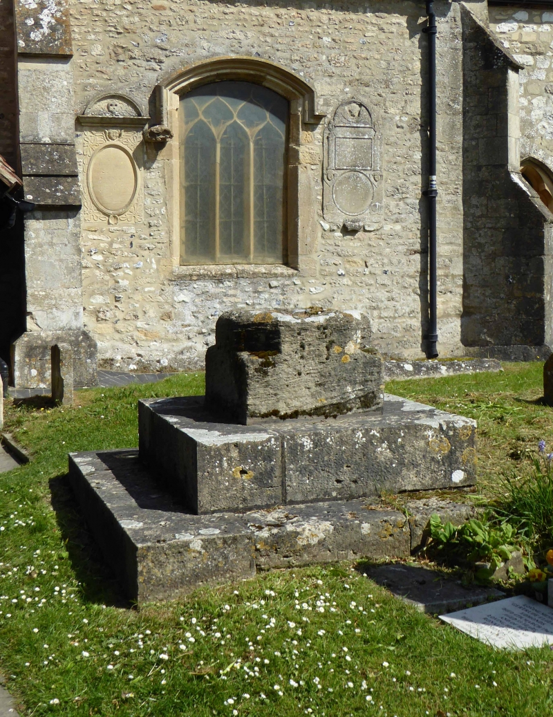
11/6 Cross approx. 4m. S of Church
of All Saints
GV II
Cross. C15 base, C19 top. Stone. Square base of 2 steps. Shaped base to
octagonal tapering shaft. C19 cross to top.
Listing NGR: SU5196890495
External links are from the relevant listing authority and, where applicable, Wikidata. Wikidata IDs may be related buildings as well as this specific building. If you want to add or update a link, you will need to do so by editing the Wikidata entry.


Other nearby listed buildings
