Latitude: 51.6372 / 51°38'13"N
Longitude: -1.134 / 1°8'2"W
OS Eastings: 460027
OS Northings: 193508
OS Grid: SU600935
Mapcode National: GBR 90N.83X
Mapcode Global: VHCYH.93CR
Plus Code: 9C3WJVP8+V9
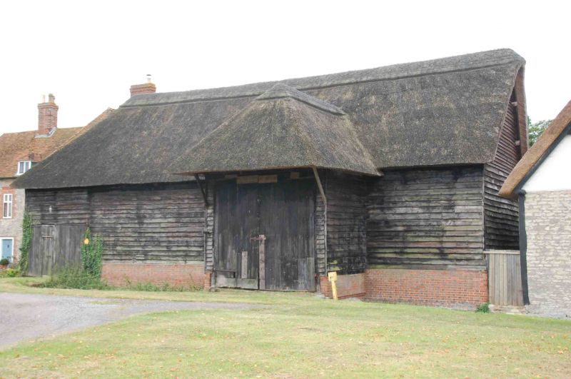
Entry Name: Barn Approximately 1 Metre North West of the Manor House
Listing Date: 18 July 1963
Last Amended: 14 May 1986
Grade: II
Source: Historic England
Source ID: 1048089
English Heritage Legacy ID: 248221
ID on this website: 101048089
Location: Warborough, South Oxfordshire, OX10
County: Oxfordshire
District: South Oxfordshire
Civil Parish: Warborough
Built-Up Area: Warborough
Traditional County: Oxfordshire
Lieutenancy Area (Ceremonial County): Oxfordshire
Church of England Parish: Warborough
Church of England Diocese: Oxford
Tagged with: Barn
WARBOROUGH THE GREEN SOUTH SU69SW (South side) 4/19 Barn approx. im. NW of The 18/07/63 Manor House (Formerly listed as barn immediately W of The Manor House)
GV II Barn. 1806 on tie beam. Weatherboarded timber framing on brick and clunch rubble plinth; thatch and old plain-tile roof. 4-bay plan with porch and aisle, extended by one bay. Front has porch, to right of centre, with hipped roof forming a canopy. Porch stands on a stone segmental-arched bridge. Plinth, rising from stream, has a rubble base, a stepped brick weathering and continues in Flemish-bond brickwork with flared headers. Roof is hipped to left over the added weatherboarded bay which forms a separate unit with entrance. Aisle to rear has a tiled roof. Interior: clasped-purl in roof with curved inner principals; bay of aisle to right of rear entrance forms separate unit; tie beam inscribed "D WHITE/J. GLANVILL 1806" also "H. BIRCH".
Listing NGR: SU6002793508
External links are from the relevant listing authority and, where applicable, Wikidata. Wikidata IDs may be related buildings as well as this specific building. If you want to add or update a link, you will need to do so by editing the Wikidata entry.


Other nearby listed buildings