Latitude: 51.5898 / 51°35'23"N
Longitude: -1.4299 / 1°25'47"W
OS Eastings: 439588
OS Northings: 188039
OS Grid: SU395880
Mapcode National: GBR 6Y5.C97
Mapcode Global: VHC12.59DL
Plus Code: 9C3WHHQC+W2
Entry Name: The Lamb Public House
Listing Date: 3 December 1969
Last Amended: 6 December 1985
Grade: II
Source: Historic England
Source ID: 1048517
English Heritage Legacy ID: 251231
Also known as: Lamb
The Lamb, Wantage
ID on this website: 101048517
Location: Belmont, Vale of White Horse, Oxfordshire, OX12
County: Oxfordshire
District: Vale of White Horse
Civil Parish: Wantage
Built-Up Area: Wantage
Traditional County: Berkshire
Lieutenancy Area (Ceremonial County): Oxfordshire
Tagged with: Pub Thatched pub
WANTAGE MILL STREET SU3988 (South side) 6/134 The Lamb Public House 03/12/69 (Formerly listed as Lamb Inn)
- II
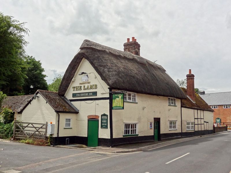
House, now public house. C17. Originally timber-framed, C19 roughcast to front and right side and brick to left side wall; thatched roof; brick stack. 2-unit lobby-entry plan. 2 storeys; 2-window range. C20 central door in C19 moulded architrave. Mid/late C19 two-light casements on ground floor, and 3-light first-floor casements. Gabled roof; ridge stack. Similar first-floor casements to rear half dormers. Interior: C20 bressumers to central open fireplaces. Chamfered beams with cyma-moulded stops and original joists throughout. Attic not inspected but likely to be of interest. Subsidiary features: Attached to right is one-storey extension, partly in square timber framing with brick infill and partly rendered, with gabled old tile roof and brick internal stack.
Listing NGR: SU3958888039
External links are from the relevant listing authority and, where applicable, Wikidata. Wikidata IDs may be related buildings as well as this specific building. If you want to add or update a link, you will need to do so by editing the Wikidata entry.


Other nearby listed buildings