Latitude: 51.5879 / 51°35'16"N
Longitude: -1.4262 / 1°25'34"W
OS Eastings: 439847
OS Northings: 187824
OS Grid: SU398878
Mapcode National: GBR 6Y6.D7Q
Mapcode Global: VHC12.7CC2
Plus Code: 9C3WHHQF+4G
Entry Name: 10 and 12, Newbury Street
Listing Date: 22 April 1950
Grade: II
Source: Historic England
Source ID: 1048520
English Heritage Legacy ID: 251241
ID on this website: 101048520
Location: Wantage, Vale of White Horse, Oxfordshire, OX12
County: Oxfordshire
District: Vale of White Horse
Civil Parish: Wantage
Built-Up Area: Wantage
Traditional County: Berkshire
Lieutenancy Area (Ceremonial County): Oxfordshire
Tagged with: Building
WANTAGE NEWBURY STREET SU3987NE (West side) 9/143 Nos. 10 and 12 22/04/50
GV II
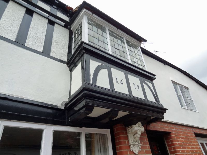
House. Late C15. Datestone on left gable stack 1679. Originally timber-framed. C18 Flemish bond brick to right, late C19 brick to left; stuccoed first floor and left side wall; old tile roof; brick stacks, left gable stack of Flemish bond brick with flared beaders. C15 hall, remodelled in mid/late C16 as 3-unit cross-passage plan. 2 storeys; 3-window range. Late C19 door and flanking casements to left, late C19 plank door and early C19 sash to right (No.10). First floor has late C19 casement to right, mid C18 three-light casement with central leaded light and late C19 anthropomorphic corbel to late C17 square bay with wood-mullioned leaded casements. Gabled roof; ridge stack and left gable end external stack with facemask beneath datestone. 2-storey, 2-window range to rear right, rendered over original C15 timber-framing with gabled old tile roof and rear end stack. Interior: Exposed timber framing with arch braces to right and rear right wing, and concealed timber-framed partition walls. Mid/late C16 chamfered and stopped ground- and first-floor beams. C17 two-panelled door to quarter-turn stairs. Chamfered and stopped bressumer over first-floor fireplace to right of centre. Smoke-blackened late C15 chamfered arch-braced collar-truss roof with clasped purlins to left of ridge stack flanked by queen-strut trusses, one to right having original wattle and daub infill. Ridge stack and ceiling with beams probably inserted in mid C16.
Listing NGR: SU3984787824
External links are from the relevant listing authority and, where applicable, Wikidata. Wikidata IDs may be related buildings as well as this specific building. If you want to add or update a link, you will need to do so by editing the Wikidata entry.


Other nearby listed buildings