Approximate Location Map
Large Map »
Latitude: 51.6194 / 51°37'9"N
Longitude: -1.5424 / 1°32'32"W
OS Eastings: 431775
OS Northings: 191278
OS Grid: SU317912
Mapcode National: GBR 6XN.DVH
Mapcode Global: VHC0T.6KYD
Plus Code: 9C3WJF95+Q2
Entry Name: Pump
Listing Date: 15 January 1986
Grade: II
Source: Historic England
Source ID: 1048683
English Heritage Legacy ID: 250837
ID on this website: 101048683
Location: Baulking, Vale of White Horse, Oxfordshire, SN7
County: Oxfordshire
District: Vale of White Horse
Civil Parish: Baulking
Traditional County: Berkshire
Lieutenancy Area (Ceremonial County): Oxfordshire
Church of England Parish: Baulking
Church of England Diocese: Oxford
Tagged with: Building
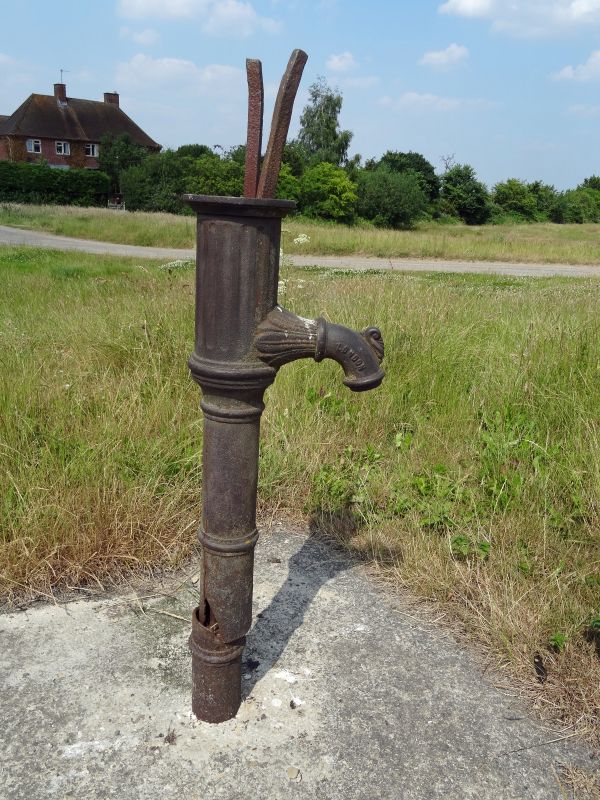
BULKING THE GREEN
SU39SW (West side)
5/8 Pump
GV II
Pump. Mid C19. Cast iron, by Warner's of London. Included for group value.
Listing NGR: SU3177591278
External links are from the relevant listing authority and, where applicable, Wikidata. Wikidata IDs may be related buildings as well as this specific building. If you want to add or update a link, you will need to do so by editing the Wikidata entry.


Other nearby listed buildings
