Latitude: 51.615 / 51°36'54"N
Longitude: -1.5568 / 1°33'24"W
OS Eastings: 430781
OS Northings: 190782
OS Grid: SU307907
Mapcode National: GBR 5W9.P77
Mapcode Global: VHC0S.YNTS
Plus Code: 9C3WJC8V+27
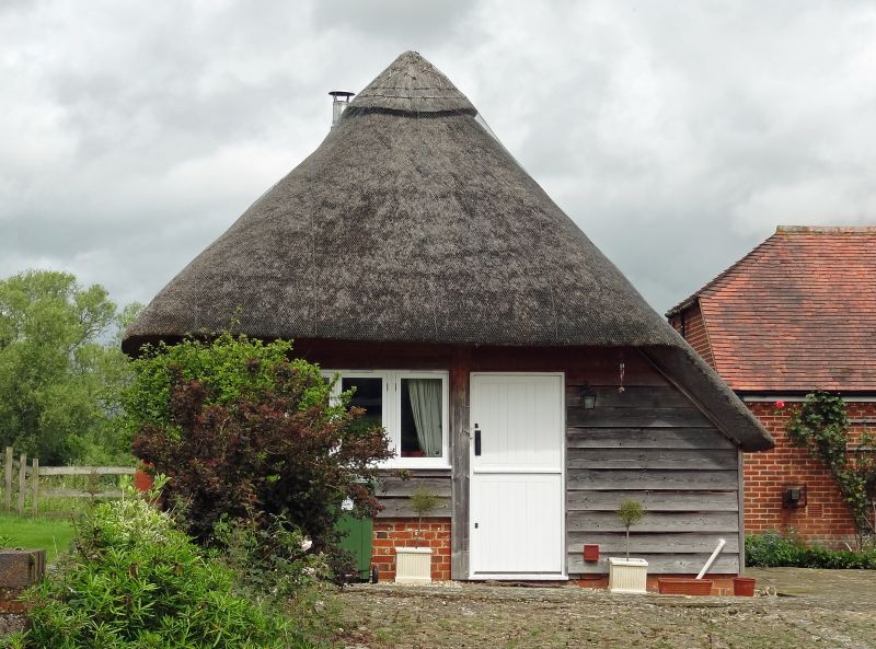
Entry Name: Moor Mill Farmhouse, Cowhouse Approximately 100 Metres North
Listing Date: 11 December 1985
Grade: II
Source: Historic England
Source ID: 1048711
English Heritage Legacy ID: 250802
ID on this website: 101048711
Location: Vale of White Horse, Oxfordshire, SN7
County: Oxfordshire
District: Vale of White Horse
Civil Parish: Uffington
Traditional County: Berkshire
Lieutenancy Area (Ceremonial County): Oxfordshire
Church of England Parish: Uffington
Church of England Diocese: Oxford
Tagged with: Building Thatched farmhouse
UFFINGTON MOOR MILL SU39SW 2/152 Moor Mill Farmhouse, cowhouse approx 100 metres north.
GV II
Cowhouse. Mid-late C18. Weatherboarded over light timber frame on brick plinth; thatched roof. 4-bay plan with single aisle and opposed entries. 4-blocked windows with shutter hinges to side walls: opposed gable entries with C18 stable doors; hipped roof. Interior: arch-braced from post to wall-plate and tie-beam; 4-bay queen-strut roof with clasped purlins. A good example retaining its old weatherboarding and fittings.
Listing NGR: SU3078190782
External links are from the relevant listing authority and, where applicable, Wikidata. Wikidata IDs may be related buildings as well as this specific building. If you want to add or update a link, you will need to do so by editing the Wikidata entry.


Other nearby listed buildings