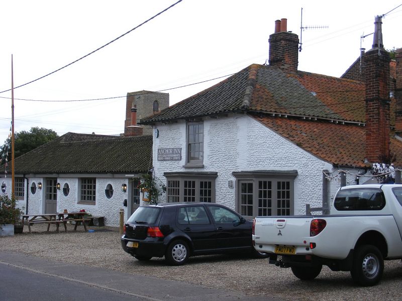
Latitude: 52.9547 / 52°57'16"N
Longitude: 0.9873 / 0°59'14"E
OS Eastings: 600763
OS Northings: 343878
OS Grid: TG007438
Mapcode National: GBR S79.QF1
Mapcode Global: WHLQM.4ZDR
Plus Code: 9F42XX3P+VW
Entry Name: The Anchor Public House
Listing Date: 20 May 1983
Grade: II
Source: Historic England
Source ID: 1049461
English Heritage Legacy ID: 223406
Also known as: Anchor
The Anchor, Holt
ID on this website: 101049461
Location: Morston, North Norfolk, NR25
County: Norfolk
District: North Norfolk
Civil Parish: Morston
Traditional County: Norfolk
Lieutenancy Area (Ceremonial County): Norfolk
Church of England Parish: Morston All Saints
Church of England Diocese: Norwich
Tagged with: Pub
TG 0043
13/105
MORSTON
THE STREET
(south side)
The Anchor Public House
II
Cottage. c1820. Walls flint, brick dressings, smut pantiles. Two storey end
gable to road (N) with outshut, ground floor 2 polygonal bay windows with glazing
bars on right with door, part glazed. First floor sash glazing bars. Deep wooden
modillion eaves c1820, Hipped roof, off-centre stack. First floor return (E)
2 casements with glazing bars, 2 lights each, C20 flat-roofed extension below.
Listing NGR: TG0076343878
External links are from the relevant listing authority and, where applicable, Wikidata. Wikidata IDs may be related buildings as well as this specific building. If you want to add or update a link, you will need to do so by editing the Wikidata entry.


Other nearby listed buildings