Latitude: 52.4937 / 52°29'37"N
Longitude: 1.1865 / 1°11'11"E
OS Eastings: 616413
OS Northings: 293193
OS Grid: TM164931
Mapcode National: GBR VHV.LSG
Mapcode Global: VHL8P.JL36
Plus Code: 9F43F5VP+FH
Entry Name: Stone Cottage
Listing Date: 26 June 1981
Grade: II
Source: Historic England
Source ID: 1050343
English Heritage Legacy ID: 225405
ID on this website: 101050343
Location: Forncett St Peter, South Norfolk, NR16
County: Norfolk
District: South Norfolk
Civil Parish: Forncett
Traditional County: Norfolk
Lieutenancy Area (Ceremonial County): Norfolk
Tagged with: Cottage
1. 5321 FORNCETT THE STREET Forncett St Peter Stone Cottage TM 19 SE 8/793
II
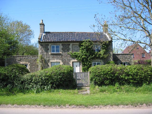
2. Early C19 cottage. Flint cobbles with buff-coloured brick dressings. Black glazed pantile roof with coped gable ends. Two storeys. Three bays. Two-light casements, centre first floor blind. Central flush-panel door. Ground floor openings have brick voussoirs. Internal brick chimney stack at each end.
Listing NGR: TM1641393193
External links are from the relevant listing authority and, where applicable, Wikidata. Wikidata IDs may be related buildings as well as this specific building. If you want to add or update a link, you will need to do so by editing the Wikidata entry.


Other nearby listed buildings