Latitude: 52.4187 / 52°25'7"N
Longitude: 1.3382 / 1°20'17"E
OS Eastings: 627096
OS Northings: 285319
OS Grid: TM270853
Mapcode National: GBR WLB.956
Mapcode Global: VHL95.4GTP
Plus Code: 9F43C89Q+F7
Entry Name: Broadwash Farmhouse
Listing Date: 26 June 1981
Grade: II
Source: Historic England
Source ID: 1050799
English Heritage Legacy ID: 226344
ID on this website: 101050799
Location: Wortwell, South Norfolk, IP20
County: Norfolk
District: South Norfolk
Civil Parish: Wortwell
Traditional County: Norfolk
Lieutenancy Area (Ceremonial County): Norfolk
Church of England Parish: Redenhall Assumption of the Blessed Virgin Mary
Church of England Diocese: Norwich
Tagged with: Farmhouse
1.
5321 WORTWELL ALBURGH ROAD
Broadwash Farmhouse
TM 18 NE 16/1295
II
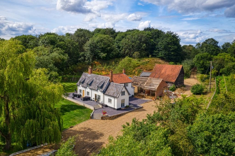
2.
C17 timber-frame house, now 2 cottages. Plastered. Steep black glazed
pantile roof with gabled ends. One storey and attic. Three dormers
with catslide roofs. Three C19, 3-light casements. Two plain doorways.
Modern brick wing on east end.
Listing NGR: TM2709685319
External links are from the relevant listing authority and, where applicable, Wikidata. Wikidata IDs may be related buildings as well as this specific building. If you want to add or update a link, you will need to do so by editing the Wikidata entry.


Other nearby listed buildings