Latitude: 53.2703 / 53°16'13"N
Longitude: -1.4267 / 1°25'36"W
OS Eastings: 438333
OS Northings: 374967
OS Grid: SK383749
Mapcode National: GBR LZGM.XD
Mapcode Global: WHDF9.12X7
Plus Code: 9C5W7HCF+48
Entry Name: The Old Mansion House
Listing Date: 26 September 1977
Grade: II
Source: Historic England
Source ID: 1051097
English Heritage Legacy ID: 83322
ID on this website: 101051097
Location: Old Whittington, Chesterfield, Derbyshire, S41
County: Derbyshire
District: Chesterfield
Electoral Ward/Division: Old Whittington
Parish: Non Civil Parish
Built-Up Area: Chesterfield
Traditional County: Derbyshire
Lieutenancy Area (Ceremonial County): Derbyshire
Church of England Parish: Whittington St Bartholomew
Church of England Diocese: Derby
Tagged with: House
CHURCH STREET NORTH 1. 5169 (West Side) Whittington Nos 9 and 11. No 15 (The Old Mansion House) SK 3874 6/174
II
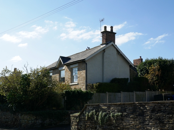
2. C17 or earlier with C18 and C19 additions and alterations. 1 building, now divided into 3 houses. Probably main facade of house once faced south. Eastern part now forms No 15 with main C19 facade to east. A schoolroom, formerly housing a Dame School, was added onto the south facade in the late C18/early Cl9. Building of coursed stone with coped plinth. East facade has slate roof with small centre gable. 2 storeys. 3 windows, late C19 sashes with stuccoed voissoirs added over plain stone lintels. Centre door in plain stone architrave. South facade has fine C17 stone doorcase. Stringcourses 2 windows (1 blocked) with dripstone moulds. Rear wing contains C17 staircase and a former external wall with blocked window. Interior of No 15 also has a C17 door and C18/early C19, 6 panelled doors. A stone fireplace with buried floor of stone flags exposed in front of hearth. Chamfered beam continues through Nos 11 and 9 to west. Said to be formerly servants quarters. 2 storeys, 2 windows each, modern casements on south side. No 11 has a low rear wing with stone slab roof, coped gable end and end chimney. C17 windows with dripstone moulds. Very low ground floor now used as cellar.
Listing NGR: SK3833374967
External links are from the relevant listing authority and, where applicable, Wikidata. Wikidata IDs may be related buildings as well as this specific building. If you want to add or update a link, you will need to do so by editing the Wikidata entry.


Other nearby listed buildings