Approximate Location Map
Large Map »
Latitude: 52.6304 / 52°37'49"N
Longitude: 1.3061 / 1°18'21"E
OS Eastings: 623832
OS Northings: 308757
OS Grid: TG238087
Mapcode National: GBR WBZ.2B
Mapcode Global: WHMTN.146T
Plus Code: 9F43J8J4+5C
Entry Name: 23, the Close
Listing Date: 5 June 1972
Grade: II
Source: Historic England
Source ID: 1051339
English Heritage Legacy ID: 228939
ID on this website: 101051339
Location: Thorpe Hamlet, Norwich, Norfolk, NR1
County: Norfolk
District: Norwich
Electoral Ward/Division: Thorpe Hamlet
Parish: Non Civil Parish
Built-Up Area: Norwich
Traditional County: Norfolk
Lieutenancy Area (Ceremonial County): Norfolk
Tagged with: Building
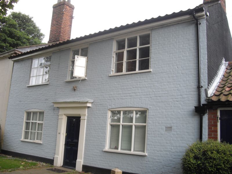
TG 2308 NE THE CLOSE
17/190
5.6.72 No. 23
GV II
House. Early C19. Painted brick and pantile roof. 2 storeys. 3 bays.
Central door with plain pilasters and simple hood. Mullion and transom
windows with metal-frame opening side-lights. Box cornice.
Listing NGR: TG2383208757
External links are from the relevant listing authority and, where applicable, Wikidata. Wikidata IDs may be related buildings as well as this specific building. If you want to add or update a link, you will need to do so by editing the Wikidata entry.


Other nearby listed buildings
