Approximate Location Map
Large Map »
Latitude: 52.6298 / 52°37'47"N
Longitude: 1.2931 / 1°17'35"E
OS Eastings: 622955
OS Northings: 308654
OS Grid: TG229086
Mapcode National: GBR W8X.WV
Mapcode Global: WHMTM.T5X7
Plus Code: 9F43J7HV+W6
Entry Name: Ironmonger's Arms
Listing Date: 5 June 1972
Grade: II
Source: Historic England
Source ID: 1051850
English Heritage Legacy ID: 229569
ID on this website: 101051850
Location: Norwich, Norfolk, NR2
County: Norfolk
District: Norwich
Electoral Ward/Division: Mancroft
Parish: Non Civil Parish
Built-Up Area: Norwich
Traditional County: Norfolk
Lieutenancy Area (Ceremonial County): Norfolk
Church of England Parish: Norwich St Peter, Mancroft with St John Maddermarket
Church of England Diocese: Norwich
Tagged with: Building
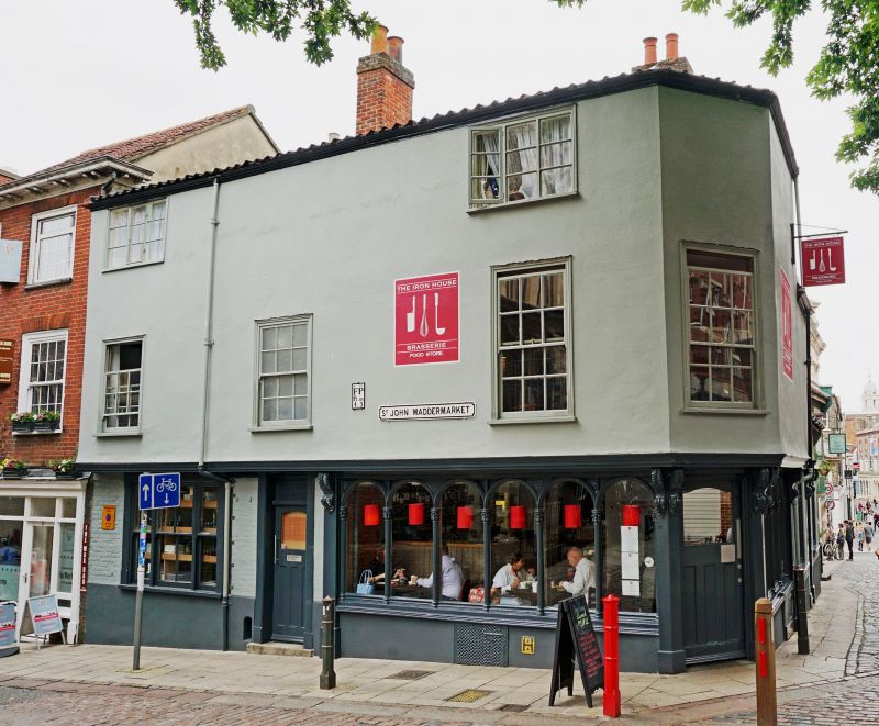
TG 2208 NE ST. JOHN MADDERMARKET
(east side)
15/795
5.6.72 No.1. (Ironmongerts Arms)
GV II
Public house. Late C17 with C18/C19 heightening and extension along
Lobster Lane. Rendered. Pantile roofs. Corner site. 3 storeys, jettied
at first floor. Single storey extension. 2 widely spaced 2nd floor
windows on St. John Maddermarket elevation. Corner entry with arcaded
windows to each side and end carved consoles beneath jetty. Plain door
to the left of the St. John Maddermarket window with sash window with
side-lights at extreme left. 3 sash windows at first floor and 2
casement windows at 2nd floor. Fascia cornice. Roof hipped at corner.
The single-storey extension has a central door with plain surround and
consoles supporting a small flat hood. Flanking arcaded windows.
Listing NGR: TG2295508654
External links are from the relevant listing authority and, where applicable, Wikidata. Wikidata IDs may be related buildings as well as this specific building. If you want to add or update a link, you will need to do so by editing the Wikidata entry.


Other nearby listed buildings
