Latitude: 52.6325 / 52°37'57"N
Longitude: 1.2993 / 1°17'57"E
OS Eastings: 623366
OS Northings: 308976
OS Grid: TG233089
Mapcode National: GBR W9X.QZ
Mapcode Global: WHMTM.X3X5
Plus Code: 9F43J7MX+2P
Entry Name: 17, Palace Street
Listing Date: 26 February 1954
Last Amended: 8 April 1986
Grade: II
Source: Historic England
Source ID: 1051935
English Heritage Legacy ID: 229380
ID on this website: 101051935
Location: The Close, Norwich, Norfolk, NR3
County: Norfolk
District: Norwich
Electoral Ward/Division: Thorpe Hamlet
Parish: Non Civil Parish
Built-Up Area: Norwich
Traditional County: Norfolk
Lieutenancy Area (Ceremonial County): Norfolk
Church of England Parish: Norwich St George, Tombland
Church of England Diocese: Norwich
Tagged with: Building
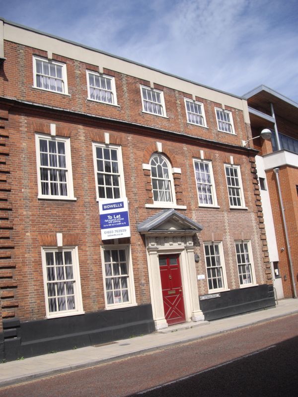
TG 2308 NW PALACE STREET (north-west side) 16/611 26.2.54. No. 17 (formerly listed as No. 15) GV II Former house now flats. C18 with C17 rear range. Red brick, roof not visible. 3 storeys with 2 storey left-side extension. 5 bays plus 2 bays. Central door with fluted pilasters supporting architrave with triglyphs and flower motif and pediment. 3-light sash window to the right of the door with dividing pilasters. Sash windows with glazing bars and rubbed brick flat arches. Central window with semi-circular arch and top sash. Keystones throughout. Moulded brick cornice beneath attic storey. Parapet and brick quoins. The 2-bay extension has sash windows with glazing bars and rubbed brick flat arches. Bracket cornice and parapet. Ground floor rooms panelled, good staircase.
Listing NGR: TG2336608975
External links are from the relevant listing authority and, where applicable, Wikidata. Wikidata IDs may be related buildings as well as this specific building. If you want to add or update a link, you will need to do so by editing the Wikidata entry.


Other nearby listed buildings