Latitude: 52.4135 / 52°24'48"N
Longitude: -0.6431 / 0°38'35"W
OS Eastings: 492385
OS Northings: 280362
OS Grid: SP923803
Mapcode National: GBR DX4.L72
Mapcode Global: VHFNS.SLVP
Plus Code: 9C4XC974+9P
Entry Name: The Post Office
Listing Date: 25 October 1951
Grade: II
Source: Historic England
Source ID: 1052054
English Heritage Legacy ID: 231090
ID on this website: 101052054
Location: Grafton Underwood, North Northamptonshire, NN14
County: North Northamptonshire
Civil Parish: Grafton Underwood
Traditional County: Northamptonshire
Lieutenancy Area (Ceremonial County): Northamptonshire
Church of England Parish: Grafton Underwood St James the Apostle
Church of England Diocese: Peterborough
Tagged with: Post office
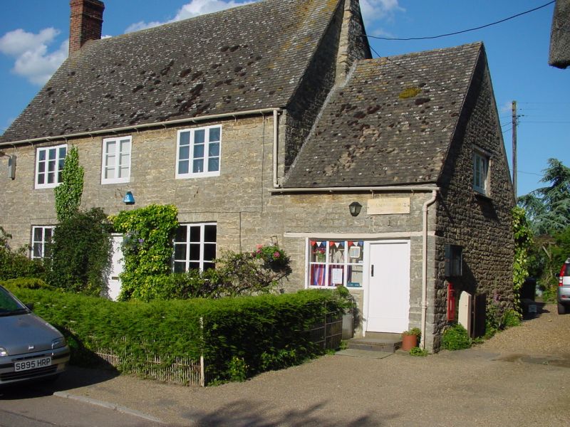
GRAFTON UNDERWOOD SP9280 GRAFTON UNDERWOOD 1337-0/16/314 No.31 25/10/51 The Post Office GV II House and post office. Probably C18. Coursed limestone rubble with roof of modern plain tiles to front slope, Welsh slates to rear. End stacks (brick shafts on slightly projecting stone chimneys). 2 storeys, 3-window range. Central 4-panel door with overlight. 2-light casement window above. 3-light windows otherwise, mostly iron-framed gudgeon-hung casements. Gauged stone heads to all openings. One storey addition to right has shop window and board door. Outshuts to rear. Interior of house not inspected.
Listing NGR: SP9238580362
External links are from the relevant listing authority and, where applicable, Wikidata. Wikidata IDs may be related buildings as well as this specific building. If you want to add or update a link, you will need to do so by editing the Wikidata entry.


Other nearby listed buildings