Approximate Location Map
Large Map »
Latitude: 51.7662 / 51°45'58"N
Longitude: -1.5669 / 1°34'0"W
OS Eastings: 429984
OS Northings: 207589
OS Grid: SP299075
Mapcode National: GBR 5TK.6P0
Mapcode Global: VHC00.SVHX
Plus Code: 9C3WQC8M+F6
Entry Name: Chest Tomb Approximately 3 Metres South of Tower and 4 Metres West of South Porch of Church of St Britius
Listing Date: 17 October 1988
Grade: II
Source: Historic England
Source ID: 1052447
English Heritage Legacy ID: 252118
ID on this website: 101052447
Location: Brize Norton, West Oxfordshire, OX18
County: Oxfordshire
District: West Oxfordshire
Civil Parish: Brize Norton
Built-Up Area: Brize Norton
Traditional County: Oxfordshire
Lieutenancy Area (Ceremonial County): Oxfordshire
Church of England Parish: Brize Norton
Church of England Diocese: Oxford
Tagged with: Chest tomb
BRIZE NORTON STATION ROAD
SP3007 (West side)
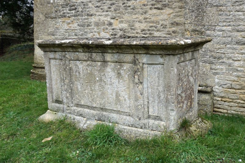
17/46 Chest tomb approx. 3m. S of
tower and 4m. W of S porch
of Church of St. Britius
GV II
Chest tomb. Date 1713 but probably mid C18. Limestone. Chamfered plinth and
coved cornice: each side has worn fielded inscription panel flanked by narrow
fielded panels.
Listing NGR: SP2998407589
External links are from the relevant listing authority and, where applicable, Wikidata. Wikidata IDs may be related buildings as well as this specific building. If you want to add or update a link, you will need to do so by editing the Wikidata entry.


Other nearby listed buildings
