Latitude: 51.6272 / 51°37'37"N
Longitude: -1.3178 / 1°19'4"W
OS Eastings: 447316
OS Northings: 192263
OS Grid: SU473922
Mapcode National: GBR 7Z2.X8M
Mapcode Global: VHCYD.3CNF
Plus Code: 9C3WJMGJ+VV
Entry Name: 14, the Green
Listing Date: 19 February 1988
Grade: II
Source: Historic England
Source ID: 1052725
English Heritage Legacy ID: 251396
ID on this website: 101052725
Location: Steventon, Vale of White Horse, Oxfordshire, OX13
County: Oxfordshire
District: Vale of White Horse
Civil Parish: Steventon
Built-Up Area: Steventon
Traditional County: Berkshire
Lieutenancy Area (Ceremonial County): Oxfordshire
Church of England Parish: Steventon
Church of England Diocese: Oxford
Tagged with: Building
STEVENTON THE GREEN SU4792 (North side) 11/80 No. 14
GV II
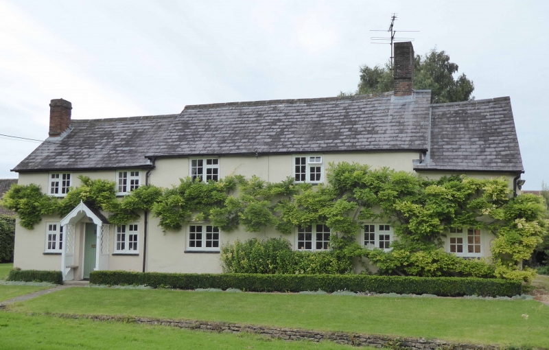
House. Probably early C17; roof raised C19; with Cl9 and C20 alterations. Render on timber-framing; slate roof; brick end stack to right. 2-storey, 2-bay range. Three C20 two-light casements to ground floor. Two C20 two-light casements to first floor. Cl9 addition to left: render, probably on brick; slate roof, 2-storey, 2-window addition, with C20 fenestration. Probably late C18 addition to right, render, probably on timber-framinq; slate roof. Single storey and attic; single-window range with C20 fenestration. C20 door to right return. Interior winder staircases to left and right of main range. Queen-post roof to main range, raised Cl9. Open fireplace to ground floor right of main range. Chamfered spine beans to ground floor of main range. Chamfered spine beams to ground floor of main range.
Listing NGR: SU4731692262
External links are from the relevant listing authority and, where applicable, Wikidata. Wikidata IDs may be related buildings as well as this specific building. If you want to add or update a link, you will need to do so by editing the Wikidata entry.


Other nearby listed buildings