Latitude: 51.9142 / 51°54'51"N
Longitude: -1.3044 / 1°18'15"W
OS Eastings: 447940
OS Northings: 224189
OS Grid: SP479241
Mapcode National: GBR 7VM.T7G
Mapcode Global: VHCX1.B4RX
Plus Code: 9C3WWM7W+M6
Entry Name: Dovecote Approximately 74 Metres East South East of Rousham House
Listing Date: 27 August 1957
Last Amended: 29 June 1988
Grade: II*
Source: Historic England
Source ID: 1052959
English Heritage Legacy ID: 252897
ID on this website: 101052959
Location: Rousham, West Oxfordshire, OX25
County: Oxfordshire
District: West Oxfordshire
Civil Parish: Rousham
Traditional County: Oxfordshire
Lieutenancy Area (Ceremonial County): Oxfordshire
Church of England Parish: Rousham
Church of England Diocese: Oxford
Tagged with: Dovecote
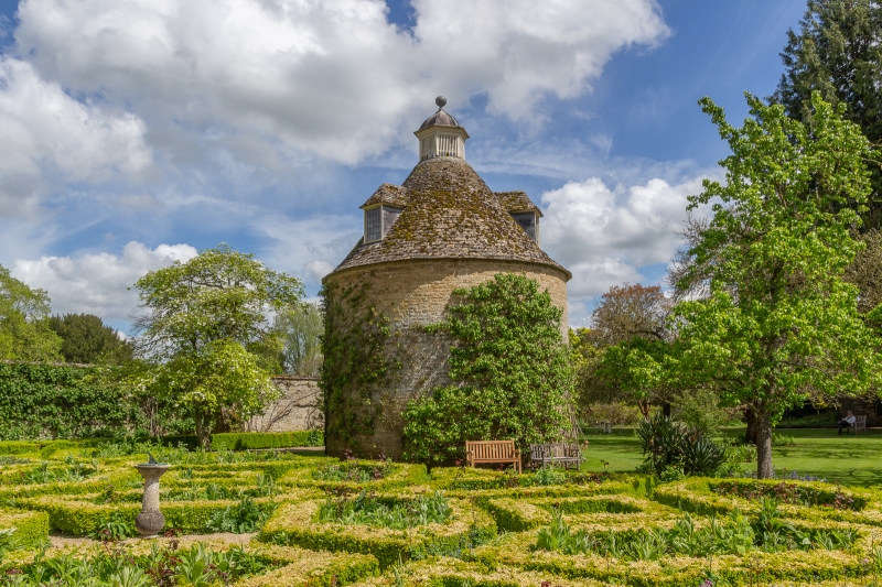
ROUSHAM ROUSHAM PARK GARDENS SP4724 14/241 Dovecote approx. 74m ESE of 27/08/57 Rousham House (Formerly listed under Rousham House, together with Dovecote and Stables) GV II* Dovecote. C17. Squared and coursed limestone; conical stone slate roof. Circular plan. Stone lintel over C20 door. Hipped dormers with leaded lights; glover with ball finial surmounts roof. Interior: stone nestings. Retains potence with ladder. Part of the landscape gardens later laid out by William Kent between 1733 and 1740. (Rousham Park is included in the H.B.M.C. Register of Parks and Gardens at Grade I; Buildings of England: Oxfordshire: p746)
Listing NGR: SP4794024189
External links are from the relevant listing authority and, where applicable, Wikidata. Wikidata IDs may be related buildings as well as this specific building. If you want to add or update a link, you will need to do so by editing the Wikidata entry.


Other nearby listed buildings