Latitude: 51.8148 / 51°48'53"N
Longitude: -1.638 / 1°38'16"W
OS Eastings: 425050
OS Northings: 212967
OS Grid: SP250129
Mapcode National: GBR 5SW.0QY
Mapcode Global: VHBZS.KND4
Plus Code: 9C3WR976+WQ
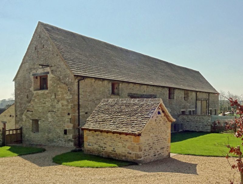
Entry Name: Two Barns Approximately 60 Metres North of Westhall Hill Manor Farmhouse
Listing Date: 12 September 1955
Last Amended: 21 August 1989
Grade: II
Source: Historic England
Source ID: 1053453
English Heritage Legacy ID: 253616
ID on this website: 101053453
Location: Westhall Hill, West Oxfordshire, OX18
County: Oxfordshire
District: West Oxfordshire
Civil Parish: Fulbrook
Traditional County: Oxfordshire
Lieutenancy Area (Ceremonial County): Oxfordshire
Church of England Parish: Fulbrook
Church of England Diocese: Oxford
Tagged with: Barn
FULBROOK WESTHALL HILL SP2512 12/59 Two barns approx. 60m N of 12/09/55 Westhall Hill Manor Farmhouse (Formerly listed as Barn 60 yards North of Manor farmhouse) GV II
Two barns. Probably late C18. Stone coursed rubble; stone slate roof. Two 5-bay barns in single structure. Gabled midstrey to centre of each barn, with plank doors, having opposing doors to rear. Interiors: trench purl in roofs to each barn.
Listing NGR: SP2505012967
External links are from the relevant listing authority and, where applicable, Wikidata. Wikidata IDs may be related buildings as well as this specific building. If you want to add or update a link, you will need to do so by editing the Wikidata entry.


Other nearby listed buildings