Latitude: 51.7375 / 51°44'14"N
Longitude: -1.6556 / 1°39'20"W
OS Eastings: 423880
OS Northings: 204365
OS Grid: SP238043
Mapcode National: GBR 5TT.27T
Mapcode Global: VHC05.8L3D
Plus Code: 9C3WP8PV+XQ
Entry Name: Filkins Farmhouse
Listing Date: 12 September 1955
Grade: II
Source: Historic England
Source ID: 1053498
English Heritage Legacy ID: 253519
ID on this website: 101053498
Location: Filkins, West Oxfordshire, GL7
County: Oxfordshire
District: West Oxfordshire
Civil Parish: Filkins and Broughton Poggs
Built-Up Area: Filkins
Traditional County: Oxfordshire
Lieutenancy Area (Ceremonial County): Oxfordshire
Church of England Parish: Broughton Poggs with Filkins
Church of England Diocese: Oxford
Tagged with: Farmhouse
SP2204-2304 FILKINS AND BROUGHTON POGGS VILLAGE STREET (North-west side) Filkins 7/197 Filkins Farmhouse 12/09/55
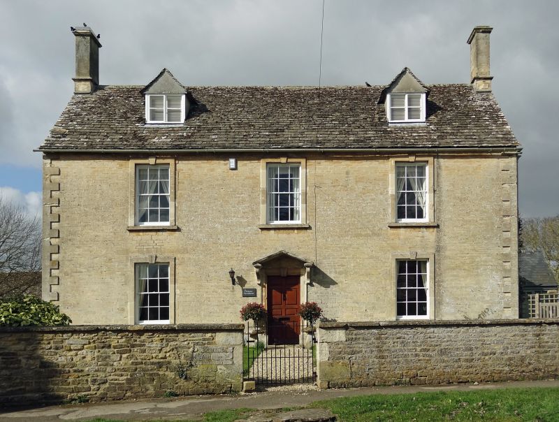
GV II Farmhouse. C18 with front wing remodelled early C19. Squared and coursed limestone front with raised ashlar quoins and window surrounds, remainder rubble stone. Stone slate roofs, the front with flanking ashlar chimneys with moulded cornices. U-plan. 2 storeys and attic, 3 bays. 3-pane sashes in raised and moulded stone surrounds with keyblocks. 2 gabled roof dormers with 2-light wooden casements. Central C20 6-panelled door in moulded stone architrave surround with moulded keyblock, stone open pediment hood on shaped scroll brackets, and semi-circular stone steps. To rear of left bay is an earlier wing of one storey and attic. This has C17-early C18 chamfered stone mullion windows with Tudor hoodmoulds. 2-storey wing to rear of right bay has one similar window in right side. Interior: front right bay has wide fireplace with depressed stone arch; altered fireplace with flat stone arch in left bay; central early C19 staircase with 2 turned balusters per tread, shaped scroll tread ends and fluted square new posts. Attic storey of wing to rear left, formerly used as cheese room, retains wooden brackets for shelving. Rear right wing formerly used for making cider.
Listing NGR: SP2388004365
External links are from the relevant listing authority and, where applicable, Wikidata. Wikidata IDs may be related buildings as well as this specific building. If you want to add or update a link, you will need to do so by editing the Wikidata entry.


Other nearby listed buildings