Latitude: 52.6349 / 52°38'5"N
Longitude: -2.278 / 2°16'40"W
OS Eastings: 381285
OS Northings: 304162
OS Grid: SJ812041
Mapcode National: GBR 07B.T1D
Mapcode Global: WH9DK.Z1FC
Plus Code: 9C4VJPMC+XR
Entry Name: The Crown Inn
Listing Date: 26 September 1984
Grade: II
Source: Historic England
Source ID: 1053699
English Heritage Legacy ID: 255120
ID on this website: 101053699
Location: Albrighton, Shropshire, WV7
County: Shropshire
Civil Parish: Albrighton
Built-Up Area: Albrighton
Traditional County: Shropshire
Lieutenancy Area (Ceremonial County): Shropshire
Church of England Parish: Albrighton St Mary Magdalene
Church of England Diocese: Lichfield
Tagged with: Inn
SJ 80 SW ALBRICHTON C.P. HIGH STREET (north side) 6/22 The Crown Inn G.V. II
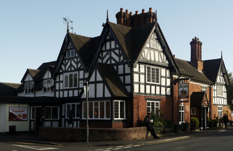
House, now inn. C16, remodelled early C18 with later additions and alterations. Red brick, timber frame, mostly planted externally, machine tiled roofs. Hall and cross-wing type converted. 2 storeys with gable lit attics; 1:3:1; windows all C20 leaded casements, transoms to those in central (hall?) range, rubbed brick flat arches, fluted keystones and bracketed sills to ground floor. Projecting 2 storey bay to left may mark the position of a former oriel, C20 central gabled porch. Plastered C18 modillion eaves cornice. Cross wings have much planted timbering above ground floor and late C19 cut bargeboards. Prominent chimneys to right of left hand cross wing with multiple stacks on massive sandstone base. Paired stacks to right of (hall?) range. Right hand cross wing is presumably a C19 addition but that on left retains partial jettying and original timbering on its left hand side.
Listing NGR: SJ8128504162
External links are from the relevant listing authority and, where applicable, Wikidata. Wikidata IDs may be related buildings as well as this specific building. If you want to add or update a link, you will need to do so by editing the Wikidata entry.


Other nearby listed buildings