Latitude: 52.557 / 52°33'25"N
Longitude: -2.3872 / 2°23'13"W
OS Eastings: 373844
OS Northings: 295534
OS Grid: SO738955
Mapcode National: GBR 084.P86
Mapcode Global: WH9DQ.9ZGL
Plus Code: 9C4VHJ47+R4
Entry Name: Rindleford Mill
Listing Date: 8 August 1988
Grade: II
Source: Historic England
Source ID: 1053715
English Heritage Legacy ID: 255075
ID on this website: 101053715
Location: Rindleford, Shropshire, WV15
County: Shropshire
Civil Parish: Worfield
Traditional County: Shropshire
Lieutenancy Area (Ceremonial County): Shropshire
Church of England Parish: Worfield
Church of England Diocese: Hereford
Tagged with: Mill
The following building shall be included:
5357 WORFIELD RINDLEFORD
SO 79 NW 15/79 Rindleford Mill
II GV
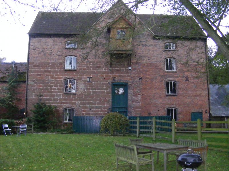
Watermill. Mid C19 with C18 origins. Buff brown brick with sandstone in part and plain-tile twin-span roof. 4 storeys. 2-window range to front, 4-window to rear, of 3-light, mainly fixed, windows under segmental brick arches. Centre of front has double height single doorway and projecting wooden hoist gantry on top floor partly within central gable. Further opening to far right on ground floor. Left half front and up to 2nd storey height is of sandstone marking the extent of the C18 structure. This walling continues round to the left end where there are also various windows including one in each gable, and two adjoining 2-storey extensions, that to right with brick lateral stack. Doorways to ground and first floors. Right end has similar fenestration and an extension in poor condition housing a large cast-iron, wood and metal sheet undershot waterwheel approximately 15' in diameter and 7' wide. Interior: chamfered spine beams to ground floor in C18 part but this altered probably in 1846, date on beam (also John ,....), which may be date of rest. Most of machinery has gone but the bedstones of 2 pairs of millstones remain together with a third pair within an iron cover inscribed 'Kay and Hilton, Liverpool' with some remains of hoists and chutes. Mid C19 cast-iron spiral stair- case. Bolted king post roofs. History: originally a fulling mill in the medieval period and used in early C18 as an oil mill, the present structure was a flour mill and also from end of C19 was used to pump water from a well to a reservoir through belting from a pulley on the wheel spindle. In 1936 it was estimated that 30,000 gallons daily were being pumped up to Bromley reservoir. (D H Robinson; The Wandering Worfe; 1982; p 12, 13, 15, 116-117).
Listing NGR: SO7384495534
External links are from the relevant listing authority and, where applicable, Wikidata. Wikidata IDs may be related buildings as well as this specific building. If you want to add or update a link, you will need to do so by editing the Wikidata entry.


Other nearby listed buildings