Approximate Location Map
Large Map »
Latitude: 52.5863 / 52°35'10"N
Longitude: -2.3559 / 2°21'21"W
OS Eastings: 375985
OS Northings: 298784
OS Grid: SO759987
Mapcode National: GBR 07S.Z1M
Mapcode Global: WH9DQ.S8B2
Plus Code: 9C4VHJPV+GM
Entry Name: Stableford Bridge (That Portion in Bridgnorth Rural District)
Listing Date: 9 March 1970
Grade: II
Source: Historic England
Source ID: 1053731
English Heritage Legacy ID: 255007
Also known as: Stableford Bridge
ID on this website: 101053731
Location: Worfield, Shropshire, WV15
County: Shropshire
Civil Parish: Worfield
Traditional County: Shropshire
Lieutenancy Area (Ceremonial County): Shropshire
Church of England Parish: Worfield
Church of England Diocese: Hereford
Tagged with: Bridge
1.
1954 WORFIELD STABLEFORD
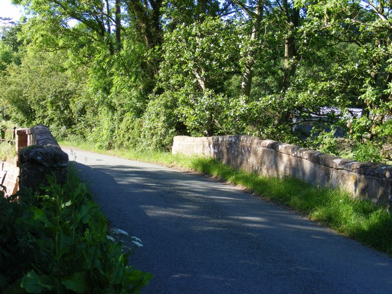
Stableford Bridge
(that portion in
Bridgnorth Rural
District)
SO 79 NE 16/59 9.3.70.
II
2.
C18. Stone, of one wide segmental span. Flat stringcourse. Plain parapets.
Listing NGR: SO7598598784
This text is from the original listing, and may not necessarily reflect the current setting of the building.
External links are from the relevant listing authority and, where applicable, Wikidata. Wikidata IDs may be related buildings as well as this specific building. If you want to add or update a link, you will need to do so by editing the Wikidata entry.


Other nearby listed buildings
