Latitude: 52.5948 / 52°35'41"N
Longitude: -2.5596 / 2°33'34"W
OS Eastings: 362191
OS Northings: 299810
OS Grid: SO621998
Mapcode National: GBR BS.9NKR
Mapcode Global: WH9DM.N1CM
Plus Code: 9C4VHCVR+W5
Entry Name: 24 and 25, High Street
Listing Date: 1 February 1974
Grade: II
Source: Historic England
Source ID: 1053820
English Heritage Legacy ID: 254811
ID on this website: 101053820
Location: Much Wenlock, Shropshire, TF13
County: Shropshire
Civil Parish: Much Wenlock
Built-Up Area: Much Wenlock
Traditional County: Shropshire
Lieutenancy Area (Ceremonial County): Shropshire
Church of England Parish: Much Wenlock with Bourton
Church of England Diocese: Hereford
Tagged with: Building
1. 1954 MUCH WENLOCK HIGH STREET (South Side) Nos 24 and 25 SO 69 NW (SJ 6200) 6/49 SO 69 NW (SO 6299) 7/49
II GV
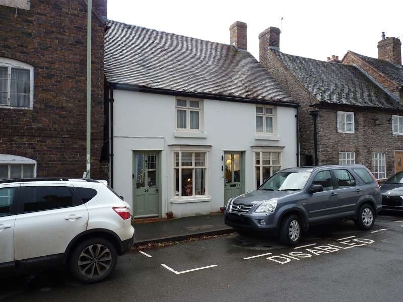
2. Early C19 stucco to earlier stone rubble; 2 storeys; 2 two-light wood mullioned windows; 2 plain doorways; 2 canted wood mullioned and transomed bay windows; tiles. Included for group value.
Nos 9 to 34 (consec), Gaskell Arms Hotel, and The Old Vicarage form a group
Listing NGR: SO6218999808
External links are from the relevant listing authority and, where applicable, Wikidata. Wikidata IDs may be related buildings as well as this specific building. If you want to add or update a link, you will need to do so by editing the Wikidata entry.


Other nearby listed buildings