Approximate Location Map
Large Map »
Latitude: 52.611 / 52°36'39"N
Longitude: -2.4785 / 2°28'42"W
OS Eastings: 367694
OS Northings: 301578
OS Grid: SJ676015
Mapcode National: GBR BW.8QJH
Mapcode Global: WH9DG.WMXP
Plus Code: 9C4VJG6C+CH
Entry Name: 20-22, Church Street
Listing Date: 1 February 1974
Grade: II
Source: Historic England
Source ID: 1053898
English Heritage Legacy ID: 254585
ID on this website: 101053898
Location: Broseley, Shropshire, TF12
County: Shropshire
Civil Parish: Broseley
Built-Up Area: Broseley
Traditional County: Shropshire
Lieutenancy Area (Ceremonial County): Shropshire
Church of England Parish: Broseley with Benthall and Jackfield
Church of England Diocese: Hereford
Tagged with: Building
1.
1954 BROSELEY BROSELEY
CHURCH STREET
(North Side)
Nos 20 to 22 (consec)
SJ 60 SE 5/9
II
2.
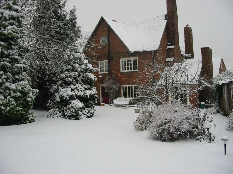
Dated 1665 on initialled tablet. Formerly a house of some importance
known as Raddle Hall but now much altered and divided into 3 cottages.
Red brick; 2 storeys plus attic; modern casement windows and simple doorcases;
plain gable on right-hand side. Returned side has central gable with
early C19 circular light; traces of earlier fenestration below; old tiles.
Listing NGR: SJ6769401578
External links are from the relevant listing authority and, where applicable, Wikidata. Wikidata IDs may be related buildings as well as this specific building. If you want to add or update a link, you will need to do so by editing the Wikidata entry.


Other nearby listed buildings
