Approximate Location Map
Large Map »
Latitude: 52.5372 / 52°32'13"N
Longitude: -2.4205 / 2°25'13"W
OS Eastings: 371575
OS Northings: 293340
OS Grid: SO715933
Mapcode National: GBR BZ.F6TK
Mapcode Global: VH90Z.0H7C
Plus Code: 9C4VGHPH+VR
Entry Name: 1-7, NORTHGATE (See details for further address information)
Listing Date: 1 February 1974
Grade: II
Source: Historic England
Source ID: 1053939
English Heritage Legacy ID: 254485
ID on this website: 101053939
Location: High Town, Shropshire, WV16
County: Shropshire
Civil Parish: Bridgnorth
Built-Up Area: Bridgnorth
Traditional County: Shropshire
Lieutenancy Area (Ceremonial County): Shropshire
Church of England Parish: Bridgnorth
Church of England Diocese: Hereford
Tagged with: Building
1.
1954 BRIDGNORTH
NORTHGATE
(East Side)
Nos 1 to 7 (consec)
SO 79 SW 2/154
II
2.
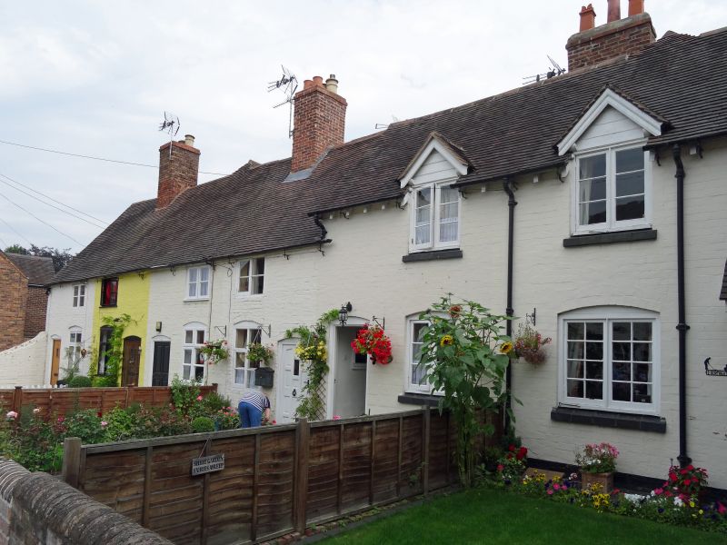
With No 16 MOAT STREET.
A C17 timber framed cottage range refaced with brick, Nos 2-7 painted.
No 1 of brown brick, projecting on right-hand side, with hipped tiled
roof, 1 casement window and a canted bay window to ground floor with glazing
bars. Nos 2-7 have 7 casement windows, 2 with gables; 4 simple doorways
with cambered heads; tiles. Gabled end of No 7 has exposed timber framing.
No 16 MOAT STREET, a small L-shaped wing tied at rear of No 1 and of similar
character has 2 sash windows and later brick porch with simple doorway.
Listing NGR: SO7157593340
External links are from the relevant listing authority and, where applicable, Wikidata. Wikidata IDs may be related buildings as well as this specific building. If you want to add or update a link, you will need to do so by editing the Wikidata entry.


Other nearby listed buildings
