Approximate Location Map
Large Map »
Latitude: 52.516 / 52°30'57"N
Longitude: -2.3864 / 2°23'11"W
OS Eastings: 373872
OS Northings: 290977
OS Grid: SO738909
Mapcode National: GBR 08Q.9GJ
Mapcode Global: VH915.L170
Plus Code: 9C4VGJ87+CC
Entry Name: The Watch-Tower, the Chantry
Listing Date: 18 July 1949
Grade: II
Source: Historic England
Source ID: 1053947
English Heritage Legacy ID: 254499
ID on this website: 101053947
Location: Quatford, Shropshire, WV15
County: Shropshire
Civil Parish: Bridgnorth
Traditional County: Shropshire
Lieutenancy Area (Ceremonial County): Shropshire
Church of England Parish: Quatford
Church of England Diocese: Hereford
Tagged with: Building
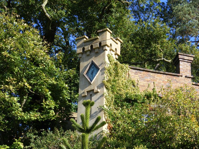
1.
1954 BRIDGNORTH
QUATFORD VILLAGE
The Watch-Tower,
The Chantry
SO 79 SW 22/266 18.7.49.
II
2.
Early C19. Largely a folly of red brick, part stuccoed, perched on a
sandstone crag; two small towers with embattlements and arrow slits; rustic
glazed windows in pointed arched recesses; clock face.
Listing NGR: SO7387290977
External links are from the relevant listing authority and, where applicable, Wikidata. Wikidata IDs may be related buildings as well as this specific building. If you want to add or update a link, you will need to do so by editing the Wikidata entry.


Other nearby listed buildings
