Latitude: 52.5339 / 52°32'2"N
Longitude: -2.4185 / 2°25'6"W
OS Eastings: 371708
OS Northings: 292977
OS Grid: SO717929
Mapcode National: GBR BZ.FF95
Mapcode Global: VH90Z.1K9V
Plus Code: 9C4VGHMJ+HH
Entry Name: 23, East Castle Street
Listing Date: 9 March 1970
Grade: II
Source: Historic England
Source ID: 1053995
English Heritage Legacy ID: 254410
ID on this website: 101053995
Location: Bridgnorth, Shropshire, WV16
County: Shropshire
Civil Parish: Bridgnorth
Built-Up Area: Bridgnorth
Traditional County: Shropshire
Lieutenancy Area (Ceremonial County): Shropshire
Church of England Parish: Bridgnorth
Church of England Diocese: Hereford
Tagged with: Building
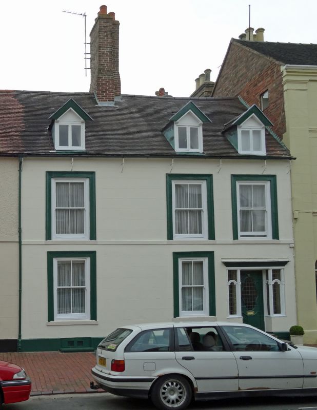
1.
1954 BRIDGNORTH
EAST CASTLE STREET
(East Side)
No 23
SO 79 SW 1/72 9.3.70.
II GV
2.
Early C19 remodelling of earlier house. Stucco; 2 storeys and attic;
3 sash windows (no glazing bars) in moulded architraves; stone band; later
doorcase withe glazed door and side-lights; 3 gabled dormers; tiles.
Included for group value.
Nos 18 to 33 (consec) form a group
Listing NGR: SO7170892977
External links are from the relevant listing authority and, where applicable, Wikidata. Wikidata IDs may be related buildings as well as this specific building. If you want to add or update a link, you will need to do so by editing the Wikidata entry.


Other nearby listed buildings