Latitude: 52.7659 / 52°45'57"N
Longitude: -2.3897 / 2°23'22"W
OS Eastings: 373802
OS Northings: 318776
OS Grid: SJ738187
Mapcode National: GBR 7Z.YVCT
Mapcode Global: WH9CR.8Q9X
Plus Code: 9C4VQJ86+94
Entry Name: Vauxhall House
Listing Date: 8 April 1983
Grade: II
Source: Historic England
Source ID: 1054125
English Heritage Legacy ID: 361921
ID on this website: 101054125
Location: Vauxhall, Telford and Wrekin, Shropshire, TF10
County: Telford and Wrekin
Civil Parish: Church Aston
Traditional County: Shropshire
Lieutenancy Area (Ceremonial County): Shropshire
Church of England Parish: Church Aston St Andrew
Church of England Diocese: Lichfield
Tagged with: House
CHURCH ASTON VAUXHALL 1. 5362 Vauxhall House
SJ 71 NW 24/65
II
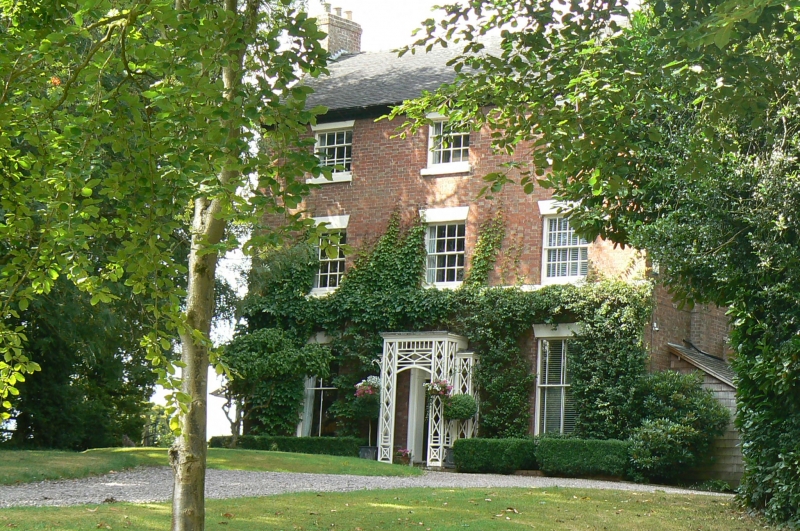
2. Early C19 red brick house. Tiled roof with gabled ends. Three storeys. Three bays. Sashes with glazing bars and plain stone lintels. Central doorway with good ornamental wood trellis porch and doorcase with rectangular fanlight. Brick end chimney stacks.
Listing NGR: SJ7380218776
External links are from the relevant listing authority and, where applicable, Wikidata. Wikidata IDs may be related buildings as well as this specific building. If you want to add or update a link, you will need to do so by editing the Wikidata entry.


Other nearby listed buildings