Approximate Location Map
Large Map »
Latitude: 52.7668 / 52°46'0"N
Longitude: -2.3771 / 2°22'37"W
OS Eastings: 374655
OS Northings: 318866
OS Grid: SJ746188
Mapcode National: GBR 7Z.YR48
Mapcode Global: WH9CR.GQ98
Plus Code: 9C4VQJ8F+P5
Entry Name: 70 and 72, Upper Bar
Listing Date: 29 June 1978
Grade: II
Source: Historic England
Source ID: 1054342
English Heritage Legacy ID: 255448
ID on this website: 101054342
Location: Newport, Telford and Wrekin, Shropshire, TF10
County: Telford and Wrekin
Civil Parish: Newport
Built-Up Area: Newport
Traditional County: Shropshire
Lieutenancy Area (Ceremonial County): Shropshire
Church of England Parish: Newport St Nicholas
Church of England Diocese: Lichfield
Tagged with: Building
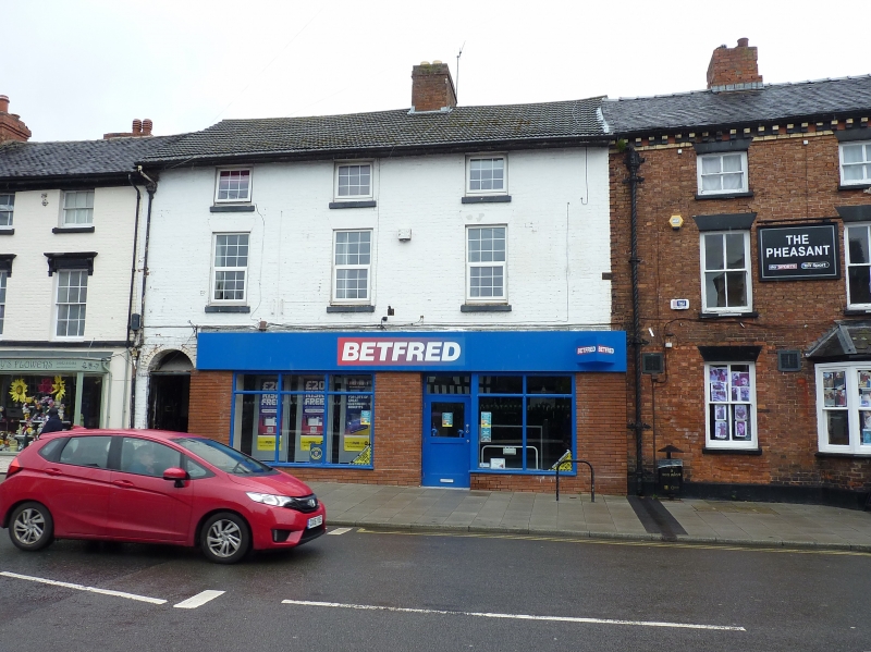
UPPER BAR
1.
5362
(East Side)
Nos 70 and 72
SJ 7418 NE 2/117
II GV
2.
Early C19. Painted brick; 3 storeys; 3 sash windows with plain lintels; plain
eaves; modern tiles. Modern shop fronts. Included for group value.
Listing NGR: SJ7465518866
External links are from the relevant listing authority and, where applicable, Wikidata. Wikidata IDs may be related buildings as well as this specific building. If you want to add or update a link, you will need to do so by editing the Wikidata entry.


Other nearby listed buildings
