Approximate Location Map
Large Map »
Latitude: 52.7701 / 52°46'12"N
Longitude: -2.3807 / 2°22'50"W
OS Eastings: 374412
OS Northings: 319239
OS Grid: SJ744192
Mapcode National: GBR 7Z.YJ7G
Mapcode Global: WH9CR.DMKQ
Plus Code: 9C4VQJC9+3P
Entry Name: 117, High Street
Listing Date: 28 April 1952
Grade: II
Source: Historic England
Source ID: 1054360
English Heritage Legacy ID: 255394
ID on this website: 101054360
Location: Newport, Telford and Wrekin, Shropshire, TF10
County: Telford and Wrekin
Civil Parish: Newport
Built-Up Area: Newport
Traditional County: Shropshire
Lieutenancy Area (Ceremonial County): Shropshire
Church of England Parish: Newport St Nicholas
Church of England Diocese: Lichfield
Tagged with: Building
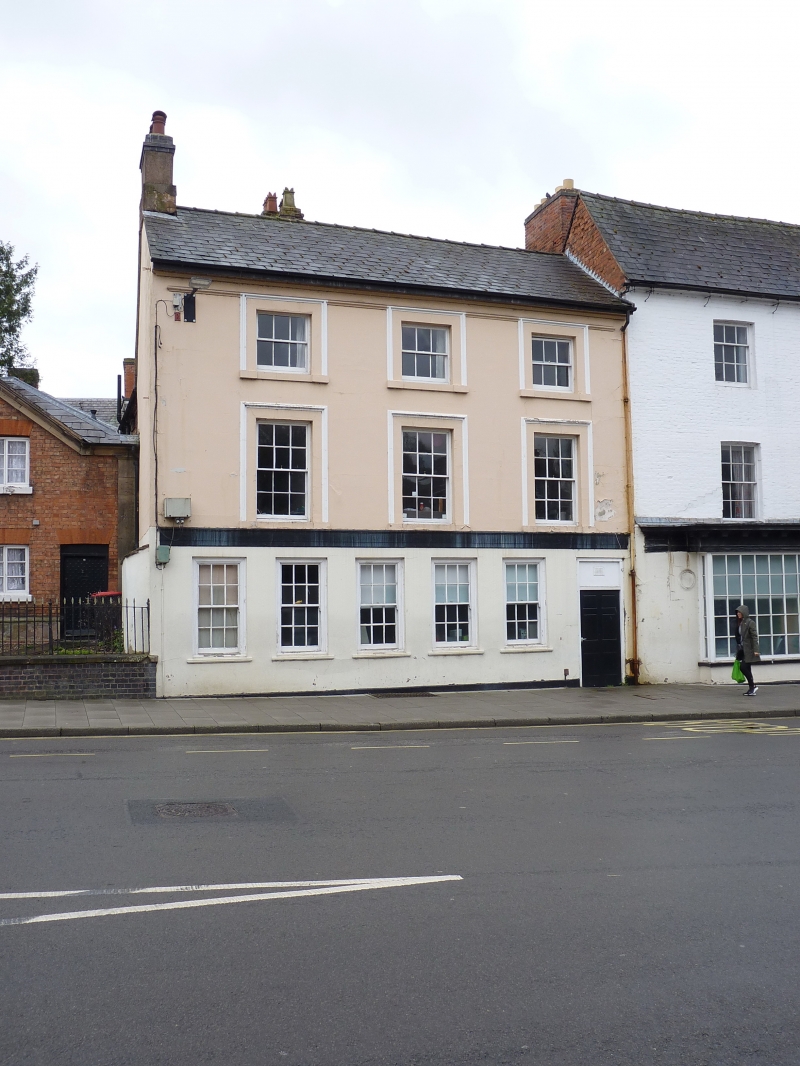
HIGH STREET
1.
5362
(West Side)
No 117
SJ 7419 SW 1/44 28.4.52.
II GV
2.
Early C19. Stucco; 3 storeys; plinth; 3 sash windows in moulded architrave
surrounds; head and sill bands at 1st storey. Ground storey has 5 sash windows,
and doorway on right-hand side with plain rectangular fanlight. Moulded eaves;
slates.
Listing NGR: SJ7441219239
External links are from the relevant listing authority and, where applicable, Wikidata. Wikidata IDs may be related buildings as well as this specific building. If you want to add or update a link, you will need to do so by editing the Wikidata entry.


Other nearby listed buildings
