Approximate Location Map
Large Map »
Latitude: 52.7706 / 52°46'14"N
Longitude: -2.3809 / 2°22'51"W
OS Eastings: 374398
OS Northings: 319288
OS Grid: SJ743192
Mapcode National: GBR 7Z.YJ66
Mapcode Global: WH9CR.DMGC
Plus Code: 9C4VQJC9+6J
Entry Name: 130A, High Street
Listing Date: 29 June 1978
Grade: II
Source: Historic England
Source ID: 1054371
English Heritage Legacy ID: 255417
ID on this website: 101054371
Location: Newport, Telford and Wrekin, Shropshire, TF10
County: Telford and Wrekin
Civil Parish: Newport
Built-Up Area: Newport
Traditional County: Shropshire
Lieutenancy Area (Ceremonial County): Shropshire
Church of England Parish: Newport St Nicholas
Church of England Diocese: Lichfield
Tagged with: Building
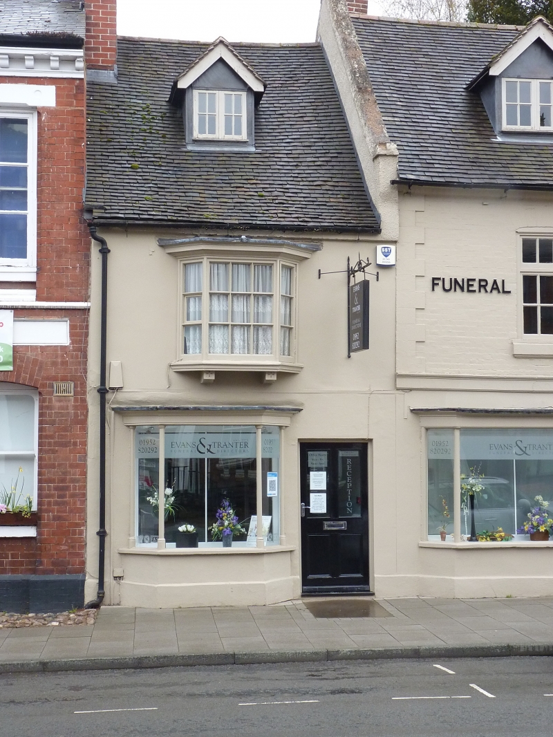
HIGH STREET
1.
5362
(East Side)
No 130A
SJ 7419 SW 1/46
II GV
2.
Late C17. Engraved stucco; 2 storeys plus attic; small splayed bay window
to ground storey with C19 splayed oriel above; old gabled dormer; plain eaves;
tiles.
Listing NGR: SJ7440419290
External links are from the relevant listing authority and, where applicable, Wikidata. Wikidata IDs may be related buildings as well as this specific building. If you want to add or update a link, you will need to do so by editing the Wikidata entry.


Other nearby listed buildings
