Approximate Location Map
Large Map »
Latitude: 54.6635 / 54°39'48"N
Longitude: -3.3666 / 3°21'59"W
OS Eastings: 311950
OS Northings: 530677
OS Grid: NY119306
Mapcode National: GBR 4GXJ.Y2
Mapcode Global: WH6ZX.814R
Plus Code: 9C6RMJ7M+99
Entry Name: 65-69, Main Street
Listing Date: 26 July 1974
Grade: II
Source: Historic England
Source ID: 1054870
English Heritage Legacy ID: 71725
ID on this website: 101054870
Location: Cockermouth, Cumberland, Cumbria, CA13
County: Cumbria
District: Allerdale
Civil Parish: Cockermouth
Built-Up Area: Cockermouth
Traditional County: Cumberland
Lieutenancy Area (Ceremonial County): Cumbria
Church of England Parish: Cockermouth Area Team
Church of England Diocese: Carlisle
Tagged with: Building
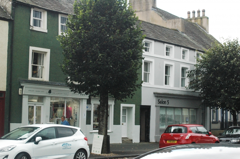
1.
5161 MAIN STREET
(South Side)
Nos 65 to 69 (odd)
NY 1130 2/70
II GV
2.
Once 2 houses, now 3. 3 low storeys. Cement and pebbledash, No 69 with stone
bands. 3 C19 shop fronts. 7 sash windows on 1st floor in stone architraves, and
8 plain sashes on top floor.
All the listed buildings on the South Side of Main Street form a group.
Listing NGR: NY1195030677
External links are from the relevant listing authority and, where applicable, Wikidata. Wikidata IDs may be related buildings as well as this specific building. If you want to add or update a link, you will need to do so by editing the Wikidata entry.


Other nearby listed buildings
