Latitude: 52.3603 / 52°21'37"N
Longitude: -2.9481 / 2°56'53"W
OS Eastings: 335532
OS Northings: 274007
OS Grid: SO355740
Mapcode National: GBR B8.SGVH
Mapcode Global: VH76J.VXBY
Plus Code: 9C4V9362+4Q
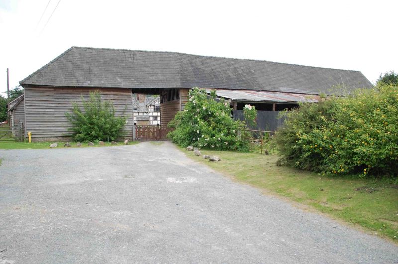
Entry Name: Barn, Cart Entrance and Loose Box Approximately 40 Metres West of the Old Farmhouse
Listing Date: 12 April 1985
Grade: II
Source: Historic England
Source ID: 1054985
English Heritage Legacy ID: 257518
ID on this website: 101054985
Location: Bucknell, Shropshire, SY7
County: Shropshire
Civil Parish: Bucknell
Built-Up Area: Bucknell
Traditional County: Shropshire
Lieutenancy Area (Ceremonial County): Shropshire
Church of England Parish: Bucknell
Church of England Diocese: Hereford
Tagged with: Barn
BUCKNELL C.P. BUCKNELL SO 37 SE 12/16 Barn, cart entrance - 12.4.85 and loose box approx. 40m west of The Old Farmhouse GV II
Barn, cart entrance and loose box. Late C17 with later alterations. Weather- boarded timber frame on roughly coursed limestone rubble plinth; corrugated iron roof, hipped to north. Slightly later 2-bay storage loft and loose box at right angles to east on north and 5-bay former threshing barn to south, flanking cart entrance to farmyard. East front: barn to left has 5 square pitching openings and central doorway; loose box to right has boarded doors to front and onto cart entrance to left. Interior. Framing visible: square panels, 3 from cill to wall-plate with short straight tension braces, some with woven infill. Long straight tension braces to bay partitions. Staggered double-purlin roof with slightly raking struts from tie beams to principal rafters; collar and tie beam end trusses with struts from collars. Stone slab threshing floor in third bay from south. Framing more renewed to loose box; central truss with curved principal rafters and queen-strut end truss with raking struts from collar. Blocked C17 segmental-headed doorway to cart entrance. The range forms oneside of a farmstead, grouped around a square courtyard with farmhouse (q.v. under The Old Farmhouse) to east.
Listing NGR: SO3553274007
External links are from the relevant listing authority and, where applicable, Wikidata. Wikidata IDs may be related buildings as well as this specific building. If you want to add or update a link, you will need to do so by editing the Wikidata entry.


Other nearby listed buildings