Latitude: 54.6185 / 54°37'6"N
Longitude: -2.0199 / 2°1'11"W
OS Eastings: 398810
OS Northings: 524817
OS Grid: NY988248
Mapcode National: GBR GHB1.H5
Mapcode Global: WHB44.Y59Q
Plus Code: 9C6VJX9J+C2
Entry Name: Former Saddle House at North Side of Entrance to Toft House Farmhouse
Listing Date: 26 June 1987
Grade: II
Source: Historic England
Source ID: 1055741
English Heritage Legacy ID: 111835
ID on this website: 101055741
Location: Egglesburn, County Durham, DL12
County: County Durham
Civil Parish: Eggleston
Traditional County: Durham
Lieutenancy Area (Ceremonial County): County Durham
Church of England Parish: Eggleston
Church of England Diocese: Durham
Tagged with: Building
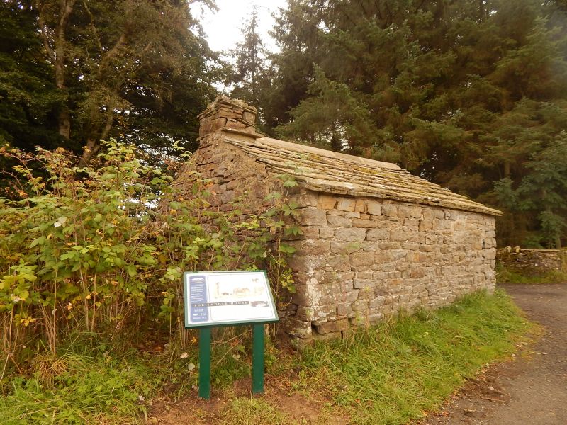
EGGLESTON TOFTRIGG PLANTATION NY92SE NY98802480 19/33 Former saddle house 26.6.87 at North side of entrance to Toft House farmhouse GV II
Probable saddle house, now farm storage building. Probably late C18 for London Lead Company. Roughly-coursed and squared sandstone with ashlar dressings; stone-flagged roof.
One-storey, one wide bay. Flat stone lintel to door at left; similar lintel and rough slab sill to square opening at right of door. Low-pitched roof has stone chimney with throughstone drip strings at base and near top. Rear to road blank.
Interior shows massive flat stone fire lintel in right return wall set on stone corbel at left, and set into wall at right; 2 square lamp recesses on rear wall and one on left wall. Roof of roughly-shaped single purlins and ridge, and similar rafters. Ridge piece broken at time of survey.
Was the storage room for pack-horse saddles, used to carry lead-ore to nearby smelt mill; building of bridge and road in C19 probably made this building redundant.
Listing NGR: NY9881024817
External links are from the relevant listing authority and, where applicable, Wikidata. Wikidata IDs may be related buildings as well as this specific building. If you want to add or update a link, you will need to do so by editing the Wikidata entry.


Other nearby listed buildings