Approximate Location Map
Large Map »
Latitude: 53.3031 / 53°18'11"N
Longitude: -1.1848 / 1°11'5"W
OS Eastings: 454420
OS Northings: 378770
OS Grid: SK544787
Mapcode National: GBR NZ57.8N
Mapcode Global: WHDF6.R7ZM
Plus Code: 9C5W8R38+63
Entry Name: Barn at Steetley Farm
Listing Date: 30 March 1982
Grade: II
Source: Historic England
Source ID: 1055832
English Heritage Legacy ID: 79346
ID on this website: 101055832
Location: Bolsover, Derbyshire, S80
County: Derbyshire
District: Bolsover
Civil Parish: Whitwell
Traditional County: Derbyshire
Lieutenancy Area (Ceremonial County): Derbyshire
Church of England Parish: Whitwell St Lawrence
Church of England Diocese: Derby
Tagged with: Barn
SK 57 NW PARISH OF WHITWELL STEETLEY LANE, STEETLEY
2/177 (West Side)
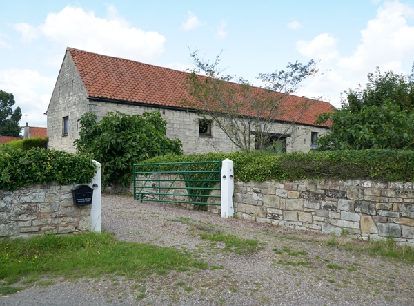
30.3.82 Barn at Steetley Farm
GV II
Barn Early C19. Coursed squared sandstone with pantile roof. East elevation has a
central cart entrance under a timber lintel. To the right is a doorway with stable-
type doors. Above are two square shuttered openings. Two tiers of slit breathers.
Listing NGR: SK5442078770
External links are from the relevant listing authority and, where applicable, Wikidata. Wikidata IDs may be related buildings as well as this specific building. If you want to add or update a link, you will need to do so by editing the Wikidata entry.


Other nearby listed buildings
