Approximate Location Map
Large Map »
Latitude: 50.9069 / 50°54'24"N
Longitude: -2.745 / 2°44'42"W
OS Eastings: 347710
OS Northings: 112200
OS Grid: ST477122
Mapcode National: GBR MJ.R2CY
Mapcode Global: FRA 564Q.2D4
Plus Code: 9C2VW743+QX
Entry Name: Milestone, 125 Metres South West of Foxwell Lane Junction at Ngr St 47711220
Listing Date: 30 August 1984
Grade: II
Source: Historic England
Source ID: 1057136
English Heritage Legacy ID: 263772
ID on this website: 101057136
Location: Middle Chinnock, Somerset, TA18
County: Somerset
District: South Somerset
Civil Parish: West and Middle Chinnock
Built-Up Area: East Chinnock
Traditional County: Somerset
Lieutenancy Area (Ceremonial County): Somerset
Tagged with: Milestone
WEST CHINNOCK CP A30
ST41SE
3/214 Milestone, 125 metres South West
of Foxwell Lane Junction at NGR
ST47711220
-
- II
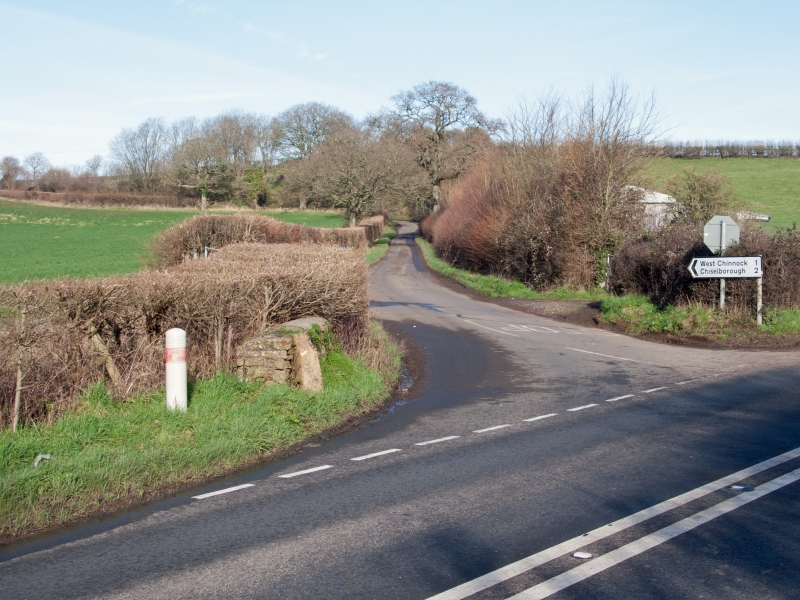
Milestone. Probably C18. Ham stone with cast iron plaque bolted on. Stone about 450mm broad x 150mm thick, with
triangular head, with about 500mm visible above bank; cast iron plaque 275mm wide x 200mm high having shouldered
semi-circular top, reads in crude recessed capitals "VI YEOVIL". On principal route maintained by Yeovil Trust from
1753 to 1839.
Listing NGR: ST4771012200
External links are from the relevant listing authority and, where applicable, Wikidata. Wikidata IDs may be related buildings as well as this specific building. If you want to add or update a link, you will need to do so by editing the Wikidata entry.


Other nearby listed buildings
