Latitude: 51.1844 / 51°11'3"N
Longitude: -3.4445 / 3°26'40"W
OS Eastings: 299140
OS Northings: 143783
OS Grid: SS991437
Mapcode National: GBR LK.5R70
Mapcode Global: VH6GM.7HXF
Plus Code: 9C3R5HM4+P6
Entry Name: 19 and 21, High Street
Listing Date: 22 May 1969
Grade: II
Source: Historic England
Source ID: 1057614
English Heritage Legacy ID: 264688
ID on this website: 101057614
Location: Dunster, Somerset, TA24
County: Somerset
District: Somerset West and Taunton
Civil Parish: Dunster
Built-Up Area: Dunster
Traditional County: Somerset
Lieutenancy Area (Ceremonial County): Somerset
Tagged with: Building
1. 5366 DUNSTER HIGH STREET (West Side)
Nos 19 and 21 SS 9843-9943 4/56 22.5.69
II GV
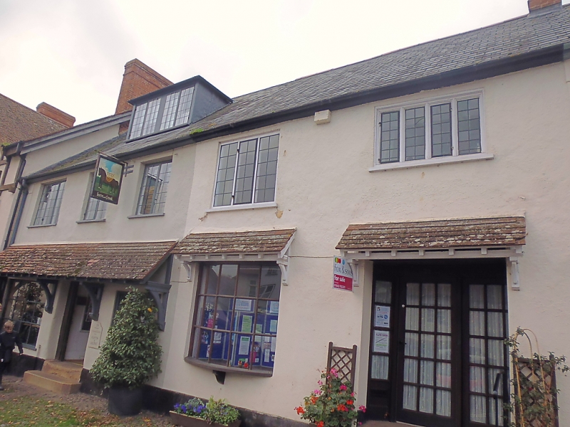
2. 17th century with later alterations. Colourwashed render, slate roof, eaves. Two storeys. Five windows, 2, 3 and 4-light leaded iron casements in wood frames, one with moulded wood mullions. Left-hand shop window framed door alongside. Modern glazed door and shop front to No 21. Later tiled pentice hoods on brackets over ground floor windows and doors.
Listing NGR: SS9913643778
External links are from the relevant listing authority and, where applicable, Wikidata. Wikidata IDs may be related buildings as well as this specific building. If you want to add or update a link, you will need to do so by editing the Wikidata entry.


Other nearby listed buildings