Approximate Location Map
Large Map »
Latitude: 51.1469 / 51°8'48"N
Longitude: -2.7188 / 2°43'7"W
OS Eastings: 349818
OS Northings: 138870
OS Grid: ST498388
Mapcode National: GBR MK.8303
Mapcode Global: VH8B3.TFKN
Plus Code: 9C3V47WJ+QF
Entry Name: 17 and 19, Benedict Street
Listing Date: 15 March 1974
Grade: II
Source: Historic England
Source ID: 1057963
English Heritage Legacy ID: 265858
ID on this website: 101057963
Location: Glastonbury, Somerset, BA6
County: Somerset
District: Mendip
Civil Parish: Glastonbury
Built-Up Area: Glastonbury
Traditional County: Somerset
Lieutenancy Area (Ceremonial County): Somerset
Tagged with: Building
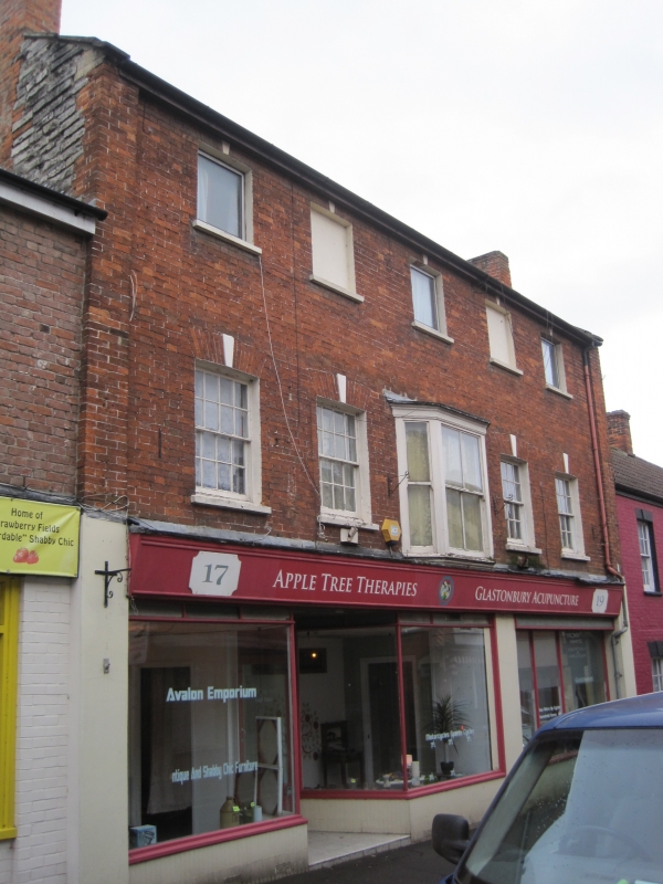
BENEDICT STREET
1.
1133
(South Side)
Nos 17 and 19
ST 4938 7/118
II GV
2.
Probably late C18. 3 storeys. Red brick. Parapets with kneelers to gable-ends.
Eaves. Brick pilasters flank front. 5 windows (2 blocked on second floor), all
with painted keystones. Sashes with glazing bars. Small bay of 3 lights in
centre of 1st floor. Sashes without glazing bars. Modern shop-front to whole of
ground-floor.
Nos 17 to 25 (odd) form a group.
Listing NGR: ST4981838870
External links are from the relevant listing authority and, where applicable, Wikidata. Wikidata IDs may be related buildings as well as this specific building. If you want to add or update a link, you will need to do so by editing the Wikidata entry.


Other nearby listed buildings
