Approximate Location Map
Large Map »
Latitude: 51.2108 / 51°12'38"N
Longitude: -2.3766 / 2°22'35"W
OS Eastings: 373788
OS Northings: 145801
OS Grid: ST737458
Mapcode National: GBR 0SL.5XN
Mapcode Global: VH97C.RTFN
Plus Code: 9C3V6J6F+89
Entry Name: Boundary Wall and Gate Piers, 10 Metres East of Fulwell House
Listing Date: 27 November 1984
Grade: II
Source: Historic England
Source ID: 1058302
English Heritage Legacy ID: 266810
ID on this website: 101058302
Location: Nunney, Somerset, BA11
County: Somerset
District: Mendip
Civil Parish: Nunney
Built-Up Area: Nunney
Traditional County: Somerset
Lieutenancy Area (Ceremonial County): Somerset
Tagged with: Wall
ST7345
12/112
NUNNEY CP
FROME ROAD (West side)
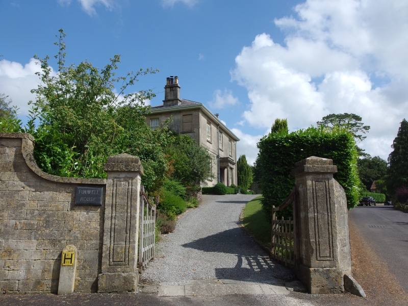
Boundary wall and gate piers, 10 metres East of Fulwell House
GV II
Boundary wall and gate piers. Early C19. Doulting ashlar wall 2 metres high, 45 metres long, bounding the Frome Road,
hipped coping. Ramped up to pair of panelled gate piers at North and South ends, pyramidal cappings, C20 wrought iron
gates.
Listing NGR: ST7378845801
External links are from the relevant listing authority and, where applicable, Wikidata. Wikidata IDs may be related buildings as well as this specific building. If you want to add or update a link, you will need to do so by editing the Wikidata entry.


Other nearby listed buildings
