Approximate Location Map
Large Map »
Latitude: 51.1469 / 51°8'48"N
Longitude: -3.02 / 3°1'11"W
OS Eastings: 328749
OS Northings: 139124
OS Grid: ST287391
Mapcode National: GBR M4.84Q1
Mapcode Global: VH7DH.LFTM
Plus Code: 9C3R4XWJ+Q2
Entry Name: Grange Farmhouse
Listing Date: 24 June 1985
Grade: II
Source: Historic England
Source ID: 1059053
English Heritage Legacy ID: 268942
ID on this website: 101059053
Location: Somerset, TA5
County: Somerset
District: Sedgemoor
Civil Parish: Wembdon
Traditional County: Somerset
Lieutenancy Area (Ceremonial County): Somerset
Tagged with: Farmhouse
ST23NE WEMBDON CP PERRY GREEN
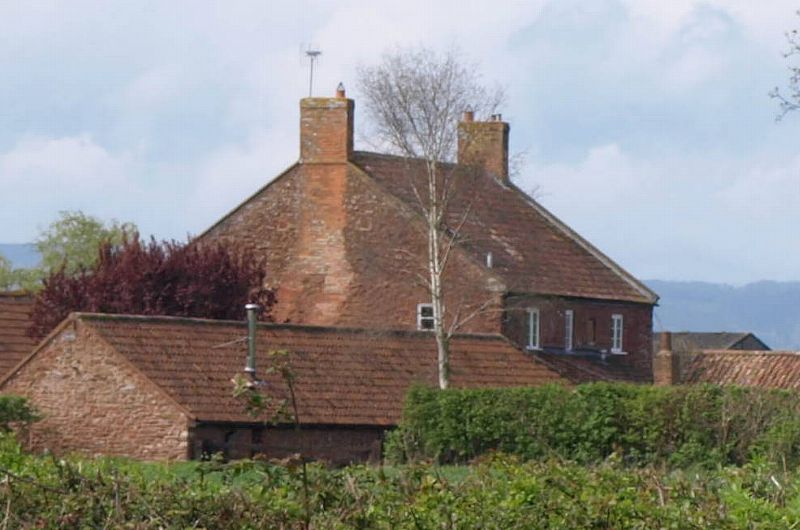
8/92 Grange Farmhouse
-
- II
Farmhouse. Early C19, Red sandstone rubble, coped verges, slate roof, end brick stacks. Symmetrical frontage; 2
storeys, 3 bays, 16-pane sash windows. Central door opening, 6-panelled door, top 2 panels glazed.
Listing NGR: ST2874939124
External links are from the relevant listing authority and, where applicable, Wikidata. Wikidata IDs may be related buildings as well as this specific building. If you want to add or update a link, you will need to do so by editing the Wikidata entry.


Other nearby listed buildings
