Approximate Location Map
Large Map »
Latitude: 51.6229 / 51°37'22"N
Longitude: -1.1013 / 1°6'4"W
OS Eastings: 462307
OS Northings: 191947
OS Grid: SU623919
Mapcode National: GBR B26.BC0
Mapcode Global: VHCYH.VGMQ
Plus Code: 9C3WJVFX+5F
Entry Name: 71, Brook Street
Listing Date: 18 July 1963
Last Amended: 28 November 1985
Grade: II
Source: Historic England
Source ID: 1059392
English Heritage Legacy ID: 247720
ID on this website: 101059392
Location: Benson, South Oxfordshire, OX10
County: Oxfordshire
District: South Oxfordshire
Civil Parish: Benson
Built-Up Area: Benson
Traditional County: Oxfordshire
Lieutenancy Area (Ceremonial County): Oxfordshire
Church of England Parish: Benson
Church of England Diocese: Oxford
Tagged with: Building
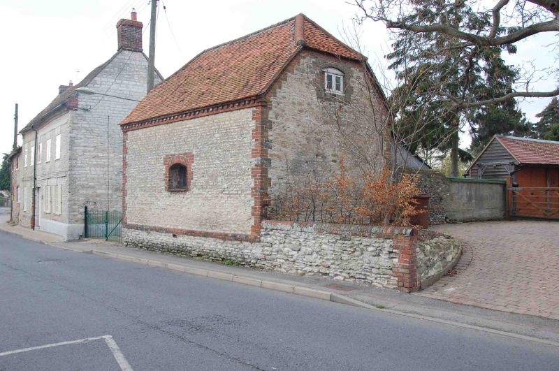
BENSON BROOK STREET
SU69SW (North side)
2/12 No.71
18/07/63 (Formerly listed as barn at
Braziers Cottage)
GV II
Barn. Probably late C18. Limestone coursed rubble with brick dressings; plain
tile half-hipped roof. Central segmental-topped window opening. Plank doors to
left return ground and first floor. Interior not inspected.
Listing NGR: SU6230791948
External links are from the relevant listing authority and, where applicable, Wikidata. Wikidata IDs may be related buildings as well as this specific building. If you want to add or update a link, you will need to do so by editing the Wikidata entry.


Other nearby listed buildings
